Within Field of View
Why Clear UFO Footage Can Still Mislead
Removing horizon, terrain and depth cues can make viewers misjudge a UFO's direction, distance and speed even when the target image is clear.
On this page
- Which visual references normally anchor motion and depth
- What high magnification removes from the scene
- Why target recognition and spatial orientation are different tasks
Page outline Jump by section
Introduction
Clear UFO footage can still be misleading when it shows the object but removes the scene needed to interpret it. A tightly cropped or highly magnified image may preserve a sharp target while excluding the horizon, terrain, clouds, landmarks and objects at known distances. Those missing references are precisely what human vision normally uses to judge orientation, depth and relative motion. Aviation human-factors guidance therefore treats seeing an object and understanding its position in space as related but distinct display requirements.[FAA Human-Systems Integration Branch]hf.tc.faa.govfull textFAA Human-Systems Integration BranchHuman Factors Criteria for Displays: A Human Factors Design Standard Update of Chapter 5June 21, 2007…

For UFO and unidentified anomalous phenomena (UAP) analysis, that distinction is important. A viewer can be confident that a video contains a real-looking object yet still be badly wrong about whether it is close to the ground, crossing the scene rapidly or moving in the direction its apparent motion suggests. Recent official analyses of the GoFast and Puerto Rico UAP videos illustrate the problem: striking impressions of speed or trajectory changed substantially once analysts reconstructed the sensor platform, viewing angles and wider geometry.[AARO]aaro.milGo Fast Case Resolution Card Methodology FinalUNCLASSIFIEDMay 10, 2026…
Which visual references normally anchor motion and depth?
Human vision does not estimate an airborne object’s distance or velocity simply by measuring how quickly its image crosses the retina. It interprets motion within a larger visual reference frame. The horizon helps establish orientation; terrain and buildings provide scale; overlapping surfaces help establish which objects are nearer; texture, detail, shadows and familiar object sizes contribute distance information; and relative movement between objects at different distances supplies motion-parallax cues. Aviation physiology guidance describes these visual references as contributors to judgements of distance, speed and depth.[NCBI]ncbi.nlm.nih.govNCBIPhysiology Of Spatial OrientationStatPearls - NCBI BookshelfAugust 14, 2023…
Peripheral vision has a particularly important role. Central, or focal, vision excels at resolving detail and identifying an object. Peripheral, or ambient, vision is much more involved in detecting broad environmental motion and establishing orientation. European Union Aviation Safety Agency guidance says peripheral information supplies the great majority of visual information used for spatial orientation in normal daytime conditions. Research archived by NASA similarly investigated artificial horizons presented to peripheral vision specifically because peripheral vision is well suited to processing orientation information.[EASA]easa.europa.euEASAEasy Access Rules for Air OperationsRevision 24, March 2026 | EASA…
This creates a counter-intuitive problem for magnified UFO imagery. Enlarging the unidentified object can improve the part of the image best suited to answering “what does it look like?” while degrading the information needed to answer “where is it, and how is it moving?” A visually impressive close-up is therefore not automatically a geometrically informative one.
The loss is especially serious when the background is nearly featureless. Consider an infrared image containing a small object against sea or sky. Without a visible horizon, coastline, cloud layer of known altitude or recognisable surface features, several very different three-dimensional situations can produce broadly similar two-dimensional images. A small nearby object and a larger distant one can occupy the same angular size. Likewise, substantial apparent movement across a background does not by itself reveal how much came from target motion, camera rotation or movement of the aircraft carrying the camera.
That ambiguity is why spatial orientation depends on a network of references rather than target clarity alone.
What high magnification removes from the scene
A narrow field of view is a trade-off. It makes a small target occupy more of the display, but it necessarily excludes more of the environment surrounding it. The Federal Aviation Administration’s human-factors standard captures this trade-off unusually clearly: its criterion for head-mounted displays says field of view should provide acceptable performance for visual search, object recognition and spatial orientation. Those requirements are listed separately because satisfying one does not guarantee the others.[FAA Human-Systems Integration Branch]hf.tc.faa.govfull textFAA Human-Systems Integration BranchHuman Factors Criteria for Displays: A Human Factors Design Standard Update of Chapter 5June 21, 2007…
Night-vision guidance provides a useful parallel. EASA notes that restricted peripheral information makes spatial orientation more demanding, and that if the horizon or ground reference becomes unavailable, crews must rely on instruments until adequate external visual references return. The operational lesson is not that a narrow image is useless. It is that an image may remain quite useful for recognising or tracking something while no longer providing enough environmental information for reliable intuitive orientation.[EASA]easa.europa.euEASAEasy Access Rules for Air OperationsRevision 24, March 2026 | EASA…
In UAP footage, magnification or cropping can remove several reference classes at once:
- The horizon, which separates apparent object movement from changes in camera attitude and supplies a powerful orientation reference.
- Terrain and landmarks, which provide stationary points against which angular movement can be interpreted.
- Objects at different depths, whose differing apparent movement helps reveal motion parallax.
- Known-size objects, which help constrain scale and therefore possible distance.
- The wider flight path, which can reveal that the sensor platform itself is turning or translating rapidly.
- The sensor footprint, which shows where the narrow image lies within the larger world.
The resulting frame can therefore contain more pixels on the target but less information about its motion. That is the central reason a tightly framed UFO video can feel more conclusive than it actually is.
Why recognition and spatial orientation are different tasks
Suppose an infrared sensor records a compact, high-contrast object clearly enough that analysts agree something is being tracked. That establishes neither its altitude nor its ground speed. Those quantities require additional geometric information.
This difference is built into professional geospatial video systems. Full-motion-video systems do not normally treat the video picture as a self-sufficient map. They associate frames with metadata such as platform position and attitude and camera-pointing information. Geospatial software can then display the sensor location, field of view and video footprint on a map, connecting what appears inside the cropped frame to the wider spatial situation.[ArcGIS]doc.esri.comArc GISIntroduction to geospatial video | Arc GIS Pro documentationArc GISIntroduction to geospatial video | Arc GIS Pro documentation
That separation is particularly revealing for UFO analysis. There are really two questions:
Recognition: What image or signature has the sensor detected?
Spatial reconstruction: Where was the sensor, where was it pointing, where could the target have been, and how did that geometry change with time?
A video can perform reasonably well on the first question and poorly on the second. A clear thermal blob, silhouette or point source may support the conclusion that the sensor detected a physical object, while providing insufficient information to determine its range or performance. AARO’s current imagery catalogue contains cases in which footage shows an apparent infrared contrast consistent with a physical source but lacks sufficient corroborating telemetry or other sensor data for a conclusive assessment of its nature or performance.[AARO]aaro.milNext - AARO UAP Imagery Acc Table…
This is also why an unidentified object need not be an anomalously moving object. Identity and performance are separate analytical questions. An object may remain unidentified because the image lacks enough detail to classify it, while its trajectory proves entirely ordinary once the viewing geometry is reconstructed.

GoFast shows how the missing frame changes the story
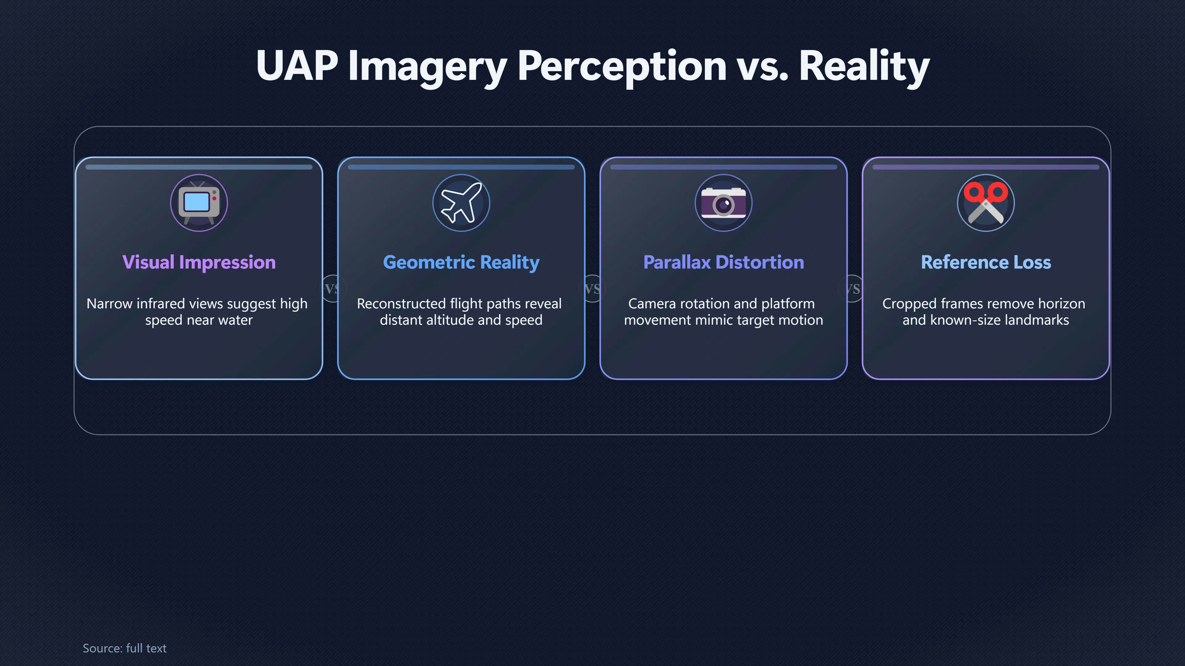
The 2015 Navy video commonly called GoFast is an unusually useful demonstration because its visual impression and reconstructed spatial interpretation differ so sharply. In the narrow infrared view, the tracked object appears to race above the ocean. With the object held near the centre and the surface passing rapidly behind it, the natural visual impression is of something travelling at remarkable speed close to the water.
But that interpretation requires assumptions about depth.
AARO’s detailed methodology report says the publicly available footage does not provide the aircraft’s location in its metadata and that the object is not a surface feature whose location can simply be calculated as a ground point. AARO therefore reconstructed the F/A-18’s flight path and examined possible target trajectories using information extracted from the video and established motion-imagery methods.[AARO]aaro.milGo Fast Case Resolution Card Methodology FinalUNCLASSIFIEDMay 10, 2026…
The crucial result is spatial rather than classificatory: AARO placed the object at roughly 13,000 feet rather than immediately above the ocean. Its analysis found that the dramatic visual impression of speed could be explained by viewing geometry and parallax rather than extraordinary target performance. The object’s precise identity is a separate issue; the important lesson here is that the apparent relationship between the target and ocean was not a reliable substitute for three-dimensional reconstruction.[AARO]aaro.milUAP Case Resolution DTUAP Case Resolution DT
GoFast therefore demonstrates a recurring perceptual trap. The ocean looks like a reference surface, so viewers instinctively treat it as if it fixes the object’s height. But without an independently established range and geometry, seeing an object against the ocean does not mean seeing an object close to the ocean. Once that mistaken depth assignment is made, apparent angular movement can be converted mentally into an exaggerated impression of physical speed.
The footage did contain numerical information useful for analysis, which is why investigators could do more than simply debate appearances. But that reinforces the broader point: interpreting the scene required recovering geometry that was not intuitively available from the narrow picture itself.
Puerto Rico shows the problem can distort direction as well as speed
The 2013 Puerto Rico infrared recording provides an even richer example because the original visual interpretation involved not just apparent speed but apparent changes in trajectory and behaviour. The footage, recorded from a US Customs and Border Protection aircraft near Rafael Hernández Airport, has been widely described as showing an object moving rapidly, apparently entering the ocean and later separating into two objects.[AARO]aaro.milPuerto Rico UAP Case ResolutionAARO Puerto Rico UAP Case Resolution…
AARO’s later reconstruction reached a very different interpretation. Working with intelligence and technical partners, it assessed that two objects were travelling close together, rather than one object physically splitting. It attributed the apparent high speed to motion parallax and concluded that the objects followed a straight path at roughly wind speed without entering the water. AARO assessed with high confidence that the objects displayed no anomalous speed or flight behaviour, while assigning moderate confidence to an identification as sky lanterns.[AARO]aaro.milPuerto Rico UAP Case ResolutionAARO Puerto Rico UAP Case Resolution…
The spatial-orientation lesson is more important here than the proposed identification. The recording platform itself was moving through a curved flight path. The sensor’s line of sight consequently changed throughout the observation. A viewer watching only the stabilised infrared scene does not intuitively experience that aircraft movement in the same way that someone looking through a wide cockpit window would.
Once the sensor path and look angle were reconstructed, behaviours that appeared to occur in the target’s world could instead be related to changes in the observer’s viewpoint. AARO says changing viewing angles also helped explain why two nearby objects could sometimes appear as one, producing the impression of splitting when both became distinguishable.[AARO]aaro.milOpen source on aaro.mil.
This is an important extension of the narrow-field-of-view problem. Lost context can distort more than a speed estimate. It can change the viewer’s understanding of which direction an object is travelling, whether its path bends, whether two objects overlap, and whether an apparent encounter with terrain or water actually occurs in three-dimensional space.
A target-centred video is not a world-centred view
Tracking systems make this perceptual problem stronger because their operational purpose is often to keep the object visible. If the sensor turns to hold a target near the centre, the display’s reference frame effectively follows the line of sight rather than remaining fixed to the Earth.
For an operator, that is useful. For an outside viewer, it can be deceptive.
The target may barely move on screen while the background streams past. A person watching the resulting clip must mentally disentangle target motion, aircraft motion and sensor rotation, yet the wide environmental references that would normally make those components obvious may be outside the frame. The result is a target-centred visual experience that can easily be mistaken for a world-centred record of movement.
Professional geospatial video tools address precisely this limitation by linking the video to a map. Metadata-compliant systems can display the sensor’s position, attitude, pointing direction, field of view and image footprint alongside the video rather than asking an analyst to infer them from the picture alone.[ArcGIS]doc.esri.comArc GISIntroduction to geospatial video | Arc GIS Pro documentationArc GISIntroduction to geospatial video | Arc GIS Pro documentation
AARO’s GoFast methodology also highlights the converse problem. It notes that military sensor footage is not necessarily collected as a full-motion-video intelligence product and may lack metadata needed for exhaustive analysis. That means some UAP recordings can preserve an excellent visual track while failing to preserve all the contextual information that would make the track straightforward to interpret geometrically.[AARO]aaro.milGo Fast Case Resolution Card Methodology FinalUNCLASSIFIEDMay 10, 2026…
That is not evidence that the recording is false, nor does it prove a mundane identification. It means the evidential questions must be separated. A strong detection record can still be a weak measurement of distance or velocity.
The governance lesson is to preserve context, not merely sharper imagery
For agencies collecting or releasing UAP footage, the practical intervention follows directly from the human-factors problem: preserve enough information to reconstruct the scene outside the crop.
Simply seeking higher resolution is insufficient. A higher-resolution image can improve shape recognition while leaving the central spatial ambiguity untouched. If analysts do not know the sensor’s position, pointing direction, attitude, field of view and relevant range information, they may still be unable to distinguish a fast distant object from a slower nearer one—or determine how much apparent movement results from the platform itself.
A better evidential package pairs target imagery with contextual data. Where security and classification rules permit, useful elements include platform position and motion, sensor azimuth and elevation, field-of-view or zoom state, accurate timestamps, range information and a wider contextual view or geospatial footprint. Professional full-motion-video practice demonstrates why such metadata matters: it makes the video geospatially aware instead of leaving each frame as an isolated two-dimensional picture.[ArcGIS]doc.esri.comArc GISIntroduction to geospatial video | Arc GIS Pro documentationArc GISIntroduction to geospatial video | Arc GIS Pro documentation
This approach also provides a useful rule for public UAP assessment. Claims about extraordinary speed, altitude changes, turns or interaction with the ground or sea deserve stronger evidential requirements than claims that an unexplained image is present. The former are measurements of three-dimensional behaviour. They require adequate geometry.
NASA’s UAP programme has likewise emphasised improving the quality and systematic character of UAP data rather than treating compelling imagery alone as decisive evidence. Its independent study was explicitly tasked with identifying better data-collection and analytical approaches that could place physical constraints on UAP observations.[NASA Science]science.nasa.govScience UAPScience UAP
Clear footage should answer two questions, not one
The safest way to read tightly cropped UFO footage is therefore to ask two separate questions. First: how well can we see the object? Second: how well can we reconstruct the space around it?
Those answers can be very different.
A recording may clearly establish that an unexplained object or sensor signature was present while remaining incapable, by itself, of establishing extraordinary speed or manoeuvring. Conversely, a visually unimpressive dot can become analytically useful when accompanied by accurate platform telemetry, range data and multiple sensor observations.
That distinction explains why loss of visual context is more than an aesthetic problem. Horizon, terrain, peripheral visual flow, known-scale objects and geospatial metadata constitute the reference frame against which motion acquires meaning. Remove them, and a viewer is left with an object but an underdetermined world.
GoFast and the Puerto Rico case demonstrate the consequence in concrete terms: behaviours that looked remarkable inside narrow sensor imagery changed substantially when investigators reconstructed the observer’s motion and the three-dimensional scene.[AARO]aaro.milGo Fast Case Resolution Card Methodology FinalUNCLASSIFIEDMay 10, 2026…
For UFO and UAP investigations, then, image clarity should never be treated as a substitute for spatial context. A sharper target can tell investigators more about what something looks like. Only an adequately reconstructed reference frame can tell them reliably where it was and how it moved.
Amazon book picks
Further Reading
Books and field guides related to Why Clear UFO Footage Can Still Mislead. Use these as the next step if you want deeper reading beyond the article.
Sensation and Perception
. Bruce Goldstein's SENSATION AND PERCEPTION, the best-seller which has helped over 150,000 students understand the ties between how we s...
Human Factors in Aviation
Fully updated and expanded, the second edition of Human Factors in Aviation serves the needs of the widespread aviation community - stude...
Computer Vision: Algorithms and Applications
Computer Vision: Algorithms and Applications explores the variety of techniques used to analyze and interpret images. It also describes c...
eBay marketplace picks
Marketplace Samples
Live-tested eBay searches with available results related to this page.
Selected fromUFO poster oneBay.co.uk.

Current eBay listing
VINTAGE UFO FLYING SAUCERS COMIC ADVERTISING A2 POSTER PRINT

Current eBay listing
I Want To Believe UFO Poster Giclée Fine Art Heavyweight Print


Endnotes
1.
Source: hf.tc.faa.gov
Title: full text
Link:https://hf.tc.faa.gov/publications/2007-human-factors-criteria-for-displays/full_text.pdf
Source snippet
FAA Human-Systems Integration BranchHuman Factors Criteria for Displays: A Human Factors Design Standard Update of Chapter 5June 21, 2007...
Published: June 21, 2007
2.
Source: easa.europa.eu
Title: EASAEasy Access Rules for Air Operations
Link:https://www.easa.europa.eu/en/document-library/easy-access-rules/online-publications/easy-access-rules-air-operations?erules-id=ERULES-1963177438-21073
Source snippet
Revision 24, March 2026 | EASA...
Published: March 2026
3.
Source: aaro.mil
Title: [Go Fast]({{ ‘go-fast/’ | relative_url }}) Case Resolution Card Methodology Final
Link:https://www.aaro.mil/Portals/136/PDFs/case_resolution_reports/AARO_GoFast_Case_Resolution_Card_Methodology_Final.pdf?ver=qXvjrruO_0MgtnTsfYnCEQ%3D%3D
Source snippet
UNCLASSIFIEDMay 10, 2026...
Published: May 10, 2026
4.
Source: aaro.mil
Title: Puerto Rico UAP Case Resolution
Link:https://www.aaro.mil/Portals/136/PDFs/case_resolution_reports/AARO_Puerto_Rico_UAP_Case_Resolution.pdf
Source snippet
AARO Puerto Rico UAP Case Resolution...
5.
Source: ncbi.nlm.nih.gov
Title: NCBIPhysiology Of Spatial Orientation
Link:https://www.ncbi.nlm.nih.gov/sites/books/NBK518976/
Source snippet
StatPearls - NCBI BookshelfAugust 14, 2023...
Published: August 14, 2023
6.
Source: ntrs.nasa.gov
Title: Technical Reports Server Theory underlying the peripheral vision horizon device
Link:https://ntrs.nasa.gov/citations/19850001741
Source snippet
NASA Technical Reports ServerTheory underlying the peripheral vision horizon device - NASA Technical Reports Server (NTRS)...
7.
Source: pro.arcgis.com
Title: Arc GIS Pro Work with the Full Motion Video player—Arc GIS Pro | Documentation
Link:https://pro.arcgis.com/en/pro-app/3.4/help/analysis/image-analyst/the-full-motion-video-player.htm
8.
Source: aaro.mil
Link:https://www.aaro.mil/Next-AARO-Home-redesign/Next-Parent/Next-AARO-UAP-Imagery-Fixed-Table/
Source snippet
Next - AARO UAP Imagery Acc Table...
9.
Source: aaro.mil
Title: UAP Case Resolution DT
Link:https://www.aaro.mil/Next-AARO-Home-redesign/Next-Parent/AARO-UAP-Case-Resolution-DT/
10.
Source: aaro.mil
Link:https://www.aaro.mil/Portals/136/PDFs/SASC_AARO_Open_Hearing_Case_Slides_19Nov2024.pdf?ver=Hec1SwKwP-4zSRJwIEIlJw%3D%3D
11.
Source: science.nasa.gov
Title: Science UAP
Link:https://science.nasa.gov/uap/
12.
Source: faa.gov
Title: Enhanced Flight Vision Systems (EFVS) | Federal Aviation Administration
Link:https://www.faa.gov/about/office_org/headquarters_offices/avs/offices/afx/afs/afs400/afs410/efvs
13.
Source: science.nasa.gov
Title: hubble glossary
Link:https://science.nasa.gov/mission/hubble/multimedia/hubble-glossary/
14.
Source: science.nasa.gov
Link:https://science.nasa.gov/uap/faqs/
15.
Source: aaro.mil
Link:https://www.aaro.mil/Next-AARO-Home-redesign/Next-Parent/Next-AARO-UAP-Imagery-Acc-Table/
16.
Source: aaro.mil
Link:https://www.aaro.mil/Next-AARO-Home-redesign/Next-Parent/Next-UAP-Report-Documents/poster/dividLink/
17.
Source: faa.gov
Link:https://www.faa.gov/aircraft/air_cert/step/disciplines/flight_deck_human_factors
18.
Source: science.nasa.gov
Link:https://science.nasa.gov/universe/glossary/
19.
Source: aaro.mil
Title: AAR O UAP Records
Link:https://www.aaro.mil/UAP-Records/fbclid/IwZXh0bgNhZW0CMTEAAR0F9nbI4TTQyu8d96BuOtBb1uVQuvapZEvLug7mWxQC4ZqlNDrM5_ejMt4_aem_q0czZMebJdVWJ-6XDLdWAA/
20.
Source: faa.gov
Link:https://www.faa.gov/dataresearch/research/medhumanfacs/oamtechreports/use-monocular-and-binocular-head-worn-display
21.
Source: faa.gov
Title: Human Factors in Aviation Safety (AVS) | Federal Aviation Administration
Link:https://www.faa.gov/aircraft/air_cert/design_approvals/human_factors
22.
Source: faa.gov
Link:https://www.faa.gov/dataresearch/research/medhumanfacs/oamtechreports/operational-and-human-factors
23.
Source: aaro.mil
Link:https://www.aaro.mil/Next-AARO-Home-redesign/Next-Parent/Presidential-UAP-Transparency-Initiative/
24.
Source: aaro.mil
Link:https://www.aaro.mil/Next-AARO-Home-redesign/Next-Parent/Presidential-UAP-Transparency-Initiative/dvpmoduleid/77396/
25.
Source: faa.gov
Title: A C 20-167B
Link:https://www.faa.gov/regulations_policies/advisory_circulars/index.cfm/go/document.information/documentID/1044323
26.
Source: data.nasa.gov
Link:https://data.nasa.gov/dataset/stereo-b-plasma-and-suprathermal-ion-composition-plastic-1-hour-proton-plasma-parameters
27.
Source: aaro.mil
Link:https://www.aaro.mil/Next-AARO-Home-redesign/Next-Parent/Presidential-UAP-Transparency-Initiative/videoid/1006159/dvpmoduleid/77396/
28.
Source: aaro.mil
Link:https://www.aaro.mil/Next-AARO-Home-redesign/Next-Parent/Presidential-UAP-Transparency-Initiative/videoid/1014101/dvpcc/false/
29.
Source: faa.gov
Title: Airman Education Programs | Federal Aviation Administration
Link:https://www.faa.gov/pilots/training/airman_education/topics_of_interest/spatial_disorientation
30.
Source: standards.nasa.gov
Title: NASA STD 2822
Link:https://standards.nasa.gov/standard/NASA/NASA-STD-2822
31.
Source: podaac.jpl.nasa.gov
Title: SWOT POE 2.0
Link:https://podaac.jpl.nasa.gov/dataset/SWOT_POE_2.0
32.
Source: aaro.mil
Link:https://www.aaro.mil/Next-AARO-Home-redesign/Next-Parent/Presidential-UAP-Transparency-Initiative/videoid/1006080/dvpcc/false/
33.
Source: aaro.mil
Link:https://www.aaro.mil/Next-AARO-Home-redesign/Next-Parent/Presidential-UAP-Transparency-Initiative/videoid/1006067/dvpmoduleid/77396/
34.
Source: nasa.gov
Title: UPDAT E: NASA Shares UAP Independent Study Report; Names Director
Link:https://www.nasa.gov/news-release/update-nasa-shares-uap-independent-study-report-names-director/
35.
Source: nasa.gov
Title: NAS A to Release, Discuss Unidentified Anomalous Phenomena Report
Link:https://www.nasa.gov/news-release/nasa-to-release-discuss-unidentified-anomalous-phenomena-report/
36.
Source: nature.com
Link:https://www.nature.com/articles/s41598-023-38554-3
37.
Source: nasa.gov
Title: NAS A Provides Coverage of Unidentified Anomalous Phenomena Meeting
Link:https://www.nasa.gov/news-release/nasa-provides-coverage-of-unidentified-anomalous-phenomena-meeting/
38.
Source: aaro.mil
Link:https://www.aaro.mil/Next-AARO-Home-redesign/Next-Parent/Presidential-UAP-Transparency-Initiative/videoid/1010272/dvpcc/false/
39.
Source: aaro.mil
Link:https://www.aaro.mil/Next-AARO-Home-redesign/Next-Parent/Presidential-UAP-Transparency-Initiative/videoid/1007720/dvpcc/false/
40.
Source: aaro.mil
Link:https://www.aaro.mil/Next-AARO-Home-redesign/Next-Parent/Presidential-UAP-Transparency-Initiative/videoid/1006062/dvpcc/false/
41.
Source: nasa.gov
Title: NAS A Announces Unidentified Aerial Phenomena Study Team Members
Link:https://www.nasa.gov/general/nasa-announces-unidentified-aerial-phenomena-study-team-members/
42.
Source: aaro.mil
Link:https://www.aaro.mil/Next-AARO-Home-redesign/Next-Parent/Presidential-UAP-Transparency-Initiative/videoid/1006060/dvpcc/false/
43.
Source: fermi.gsfc.nasa.gov
Title: Scat Files
Link:https://fermi.gsfc.nasa.gov/ssc/data/analysis/gbm/gbm_data_tools/gdt-docs/notebooks/ScatFiles.html
44.
Source: faa.gov
Title: A C 90-106B
Link:https://www.faa.gov/regulations_policies/advisory_circulars/index.cfm/go/document.information/documentID/1040987
45.
Source: aaro.mil
Link:https://www.aaro.mil/Next-AARO-Home-redesign/Next-Parent/Presidential-UAP-Transparency-Initiative/videoid/1010263/dvpcc/false/
46.
Source: aaro.mil
Link:https://www.aaro.mil/Next-AARO-Home-redesign/Next-Parent/Presidential-UAP-Transparency-Initiative/videoid/1007740/dvpcc/false/
47.
Source: aaro.mil
Link:https://www.aaro.mil/Next-AARO-Home-redesign/Next-Parent/Presidential-UAP-Transparency-Initiative/videoid/1007707/dvpcc/false/
48.
Source: imagine.gsfc.nasa.gov
Link:https://imagine.gsfc.nasa.gov/resources/dictionary.html
49.
Source: aaro.mil
Link:https://www.aaro.mil/Next-AARO-Home-redesign/Next-Parent/Presidential-UAP-Transparency-Initiative/videoid/1006105/dvpmoduleid/77396/
50.
Source: faa.gov
Title: Chapter 8. Medical Facts for Pilots
Link:https://www.faa.gov/air_traffic/publications/atpubs/aim/aim0801.html
51.
Source: hfcc.dot.gov
Title: zz FAA General Guidance Doc Chapter 02 Section 03
Link:https://hfcc.dot.gov/publications/docs/GeneralGuidance/zz_FAA_GeneralGuidanceDoc_Chapter_02_Section_03.html
52.
Source: faa.gov
Link:https://www.faa.gov/about/office_org/headquarters_offices/avs/offices/aam/cami/library/online_libraries/aerospace_medicine/sd/mechanism
53.
Source: hf.tc.faa.gov
Title: 2007 human factors criteria for displays
Link:https://hf.tc.faa.gov/publications/2007-human-factors-criteria-for-displays/
54.
Source: espo.nasa.gov
Title: Ames Format Specification v20
Link:https://espo.nasa.gov/content/Ames_Format_Specification_v20
55.
Source: science.nasa.gov
Title: hubble observes planetoid sedna mystery deepens
Link:https://science.nasa.gov/missions/hubble/hubble-observes-planetoid-sedna-mystery-deepens/
56.
Source: science.nasa.gov
Title: sedna mystery deepens as hubble offers best look at farthest planetoid
Link:https://science.nasa.gov/asset/hubble/sedna-mystery-deepens-as-hubble-offers-best-look-at-farthest-planetoid/
57.
Source: science.nasa.gov
Title: plot of planetoid sednas apparent motion through space from 2003 to 2005
Link:https://science.nasa.gov/asset/hubble/plot-of-planetoid-sednas-apparent-motion-through-space-from-2003-to-2005/
58.
Source: science.nasa.gov
Title: sedna new mystery 2
Link:https://science.nasa.gov/asset/hubble/sedna-new-mystery-2/
59.
Source: ntrs.nasa.gov
Link:https://ntrs.nasa.gov/citations/20040034745
60.
Source: science.nasa.gov
Title: height and motion of the chikurachki eruption plume 3418
Link:https://science.nasa.gov/earth/earth-observatory/height-and-motion-of-the-chikurachki-eruption-plume-3418/
61.
Source: ntrs.nasa.gov
Link:https://ntrs.nasa.gov/citations/20040000685
62.
Source: faa.gov
Title: Office of Aerospace Medicine Technical Reports | Federal Aviation Administration
Link:https://www.faa.gov/data_research/research/med_humanfacs/oamtechreports/2000s/2001/0117
63.
Source: science.nasa.gov
Title: hubble sees bare neutron star streaking across space
Link:https://science.nasa.gov/missions/hubble/hubble-sees-bare-neutron-star-streaking-across-space/
64.
Source: ntrs.nasa.gov
Link:https://ntrs.nasa.gov/citations/19950015355
65.
Source: data.nasa.gov
Link:https://data.nasa.gov/dataset/ground-based-global-navigation-satellite-system-gnss-gps-real-time-pod-orbits-60-second-sa
66.
Source: data.nasa.gov
Link:https://data.nasa.gov/dataset/ground-based-global-navigation-satellite-system-gnss-galileo-real-time-pod-orbits-60-secon
67.
Source: ntrs.nasa.gov
Link:https://ntrs.nasa.gov/citations/19870055532
68.
Source: ntrs.nasa.gov
Link:https://ntrs.nasa.gov/citations/19850001747
69.
Source: ntrs.nasa.gov
Link:https://ntrs.nasa.gov/archive/nasa/casi.ntrs.nasa.gov/19850001742.pdf
70.
Source: ntrs.nasa.gov
Link:https://ntrs.nasa.gov/citations/19850001737
71.
Source: ntrs.nasa.gov
Link:https://ntrs.nasa.gov/citations/19850001743
72.
Source: ntrs.nasa.gov
Link:https://ntrs.nasa.gov/citations/19850001750
73.
Source: ntrs.nasa.gov
Link:https://ntrs.nasa.gov/citations/19770055181
74.
Source: hf.faa.gov
Link:https://www.hf.faa.gov/visibility/help.aspx
75.
Source: faa.gov
Link:https://www.faa.gov/data_research/research/med_humanfacs/oamtechreports/1960s/1968/196811
76.
Source: faa.gov
Link:https://www.faa.gov/Air_traffic/publications/atpubs/aim_html/chap5_section_4.html
77.
Source: faa.gov
Link:https://www.faa.gov/air_traffic/publications/atpubs/aip_html/part2_enr_section_1.5.html
78.
Source: faa.gov
Title: Chapter 8. Medical Facts for Pilots8-1-6. VISION IN FLIGHT 1
Link:https://www.faa.gov/Air_traffic/publications/atpubs/aim_html/chap8_section_1.html
79.
Source: faa.gov
Link:https://www.faa.gov/taxonomy/term/3616
80.
Source: hf.tc.faa.gov
Link:https://hf.tc.faa.gov/hfds/
81.
Source: doc.arcgis.com
Link:https://doc.arcgis.com/en/allsource/latest/data/introduction-to-full-motion-video-in-arcgis-pro.htm
82.
Source: doc.arcgis.com
Link:https://doc.arcgis.com/en/allsource/1.0/data/introduction-to-full-motion-video-in-arcgis-pro.htm
83.
Source: pro.arcgis.com
Link:https://pro.arcgis.com/en/pro-app/3.3/help/analysis/image-analyst/introduction-to-full-motion-video-in-arcgis-pro.htm
84.
Source: pro.arcgis.com
Title: fmv metadata player
Link:https://pro.arcgis.com/en/pro-app/3.4/help/analysis/image-analyst/fmv-metadata-player.htm
85.
Source: doc.arcgis.com
Title: visualizing full motion imagery
Link:https://doc.arcgis.com/en/imagery/workflows/resources/visualizing-full-motion-imagery.htm
86.
Source: doc.arcgis.com
Title: fmv video player tutorial
Link:https://doc.arcgis.com/en/imagery/workflows/tutorials/fmv-video-player-tutorial.htm
87.
Source: cdaweb.gsfc.nasa.gov
Link:https://cdaweb.gsfc.nasa.gov/cgi-bin/eval2.cgi?dataset=MMS1_FPI_FAST_L2_DIS-DIST&index=sp_phys
88.
Source: pds.nasa.gov
Title: view Collection.jsp
Link:https://pds.nasa.gov/ds-view/pds/viewCollection.jsp?identifier=urn%3Anasa%3Apds%3Aulysses-urap%3Adocument&version=1.0
89.
Source: apps.jpl.nasa.gov
Link:https://apps.jpl.nasa.gov/
90.
Source: podaac.jpl.nasa.gov
Title: PO.DAA C Data Management Practices
Link:https://podaac.jpl.nasa.gov/PO.DAAC_DataManagementPractices
91.
Source: apps.jpl.nasa.gov
Link:https://apps.jpl.nasa.gov/howto
92.
Source: aaro.mil
Link:https://www.aaro.mil/UAP-Cases/Official-UAP-Imagery/4/
93.
Source: aaro.mil
Link:https://www.aaro.mil/Next-AARO-Home-redesign/Inactive-Parent/FAQ-Datatable/
94.
Source: aaro.mil
Link:https://www.aaro.mil/UAP-Cases/Official-UAP-Imagery/ftag/MSF0951a18/
95.
Source: aaro.mil
Link:https://www.aaro.mil/Next-AARO-Home-redesign/Next-Parent/Next-UAP-Case-RR-Data-Table/
96.
Source: aaro.mil
Title: UAP Imagery* “Go Fast” Object NAVAIR
Link:https://www.aaro.mil/Next-AARO-Home-redesign/Inactive-Parent/Next-UAP-Imagery-dup/
97.
Source: aaro.mil
Link:https://www.aaro.mil/FAQ/
98.
Source: aaro.mil
Title: AAR O UAP Trends All-domain Anomaly Resolution Office UAP REPORTING TRENDS
Link:https://www.aaro.mil/UAP-Cases/UAP-Reporting-Trends/
99.
Source: aaro.mil
Link:https://www.aaro.mil/Next-AARO-Home-redesign/Next-Parent/Next-AARO-UAP-Trends/
100.
Source: aaro.mil
Link:https://www.aaro.mil/Next-AARO-Home-redesign/Inactive-Parent/Next-AARO-UAP-DT-Records/
101.
Source: aaro.mil
Link:https://www.aaro.mil/Resources/Historical-Record-Reports/Volume-II/
102.
Source: doc.esri.com
Title: Arc GISIntroduction to geospatial video | Arc GIS Pro documentation
Link:https://doc.esri.com/en/arcgis-pro/latest/help/analysis/image-analyst/introduction-to-full-motion-video-in-arcgis-pro.html
103.
Source: support.esri.com
Title: Support Full-Motion Video Definition | GIS Dictionary
Link:https://support.esri.com/en-us/gis-dictionary/full-motion-video
104.
Source: easa.europa.eu
Title: easy access rules aircrew
Link:https://www.easa.europa.eu/en/document-library/easy-access-rules/online-publications/easy-access-rules-aircrew?erules-id=ERULES-1963177438-10572
105.
Source: pmc.ncbi.nlm.nih.gov
Link:https://pmc.ncbi.nlm.nih.gov/articles/PMC13121174/
106.
Source: pmc.ncbi.nlm.nih.gov
Link:https://pmc.ncbi.nlm.nih.gov/articles/PMC12816412/
107.
Source: support.esri.com
Title: what misb compliant metadata attributes should data hav 000015970
Link:https://support.esri.com/es-es/knowledge-base/what-misb-compliant-metadata-attributes-should-data-hav-000015970
108.
Source: support.esri.com
Title: what misb compliant metadata attributes should data hav 000015970
Link:https://support.esri.com/de-de/knowledge-base/what-misb-compliant-metadata-attributes-should-data-hav-000015970
109.
Source: pmc.ncbi.nlm.nih.gov
Link:https://pmc.ncbi.nlm.nih.gov/articles/PMC12115827/
110.
Source: pmc.ncbi.nlm.nih.gov
Link:https://pmc.ncbi.nlm.nih.gov/articles/PMC11766877/
111.
Source: esri.com
Title: Video Multiplexer Geoprocessing Tool to Format your Metadata
Link:https://www.esri.com/arcgis-blog/products/arcgis-pro/imagery/video-multiplexer-tips-tricks
112.
Source: easa.europa.eu
Title: easy access rules aircrew regulation eu no
Link:https://www.easa.europa.eu/en/document-library/easy-access-rules/online-publications/easy-access-rules-aircrew-regulation-eu-no?kw=LAPL&page=8
113.
Source: navysbir.com
Link:https://www.navysbir.com/n23_A/N23A-T011.htm
114.
Source: easa.europa.eu
Title: eu Easy Access Rules for All-Weather Operations (CS-AWO)
Link:https://www.easa.europa.eu/en/document-library/easy-access-rules/online-publications/easy-access-rules-all-weather-operations-cs?page=14
115.
Source: GOV.UK
Title: www.gov.uk Competition
Link:https://www.gov.uk/government/publications/competition-advanced-vision-for-2020-and-beyond/competition-summary-document-advanced-vision-for-2020-and-beyond
116.
Source: support.esri.com
Title: what misb compliant metadata attributes should data hav 000015970
Link:https://support.esri.com/en-us/knowledge-base/what-misb-compliant-metadata-attributes-should-data-hav-000015970
117.
Source: pmc.ncbi.nlm.nih.gov
Link:https://pmc.ncbi.nlm.nih.gov/articles/PMC4901450/
118.
Source: pubmed.ncbi.nlm.nih.gov
Link:https://pubmed.ncbi.nlm.nih.gov/27269599/
119.
Source: pubmed.ncbi.nlm.nih.gov
Link:https://pubmed.ncbi.nlm.nih.gov/25850158/
120.
Source: trid.trb.org
Link:https://trid.trb.org/View/1345535
121.
Source: pmc.ncbi.nlm.nih.gov
Link:https://pmc.ncbi.nlm.nih.gov/articles/PMC3710190/
122.
Source: rosap.ntl.bts.gov
Link:https://rosap.ntl.bts.gov/view/dot/71695
123.
Source: trid.trb.org
Link:https://trid.trb.org/View/768025
124.
Source: pubmed.ncbi.nlm.nih.gov
Link:https://pubmed.ncbi.nlm.nih.gov/9184732/
125.
Source: doc.esri.com
Title: motion imagery geoprocessing functions
Link:https://doc.esri.com/en/arcgis-pro/latest/arcpy/image-analyst/motion-imagery-geoprocessing-functions.html
126.
Source: doc.esri.com
Title: video metadata to feature class
Link:https://doc.esri.com/en/arcgis-pro/latest/tool-reference/image-analyst/video-metadata-to-feature-class.html
127.
Source: pubmed.ncbi.nlm.nih.gov
Link:https://pubmed.ncbi.nlm.nih.gov/11541915/
128.
Source: pubmed.ncbi.nlm.nih.gov
Link:https://pubmed.ncbi.nlm.nih.gov/19378915/
129.
Source: pubmed.ncbi.nlm.nih.gov
Link:https://pubmed.ncbi.nlm.nih.gov/9184733/
130.
Source: trid.trb.org
Link:https://trid.trb.org/View/1097481
131.
Source: trid.trb.org
Link:https://trid.trb.org/View/795924
Additional References
132.
Source: youtube.com
Title: The SHOCKING Math Error Behind Viral UFO Videos | Mick West
Link:https://www.youtube.com/watch?v=ypfbhfEXnBo
Source snippet
GOFAST UFO Analysis (yeah no, probably just a balloon)...
133.
Source: ntsb.gov
Link:https://www.ntsb.gov/news/press-releases/Pages/NR20210209.aspx
134.
Source: youtube.com
Title: GOFAST UFO Analysis (yeah no, probably just a balloon)
Link:https://www.youtube.com/watch?v=-3NYowlCoDc
Source snippet
Breakdown of the Pentagon UFO videos with Mick West...
135.
Source: youtube.com
Title: Breakdown of the Pentagon UFO videos with Mick West
Link:https://www.youtube.com/watch?v=Le7Fqbsrrm8
Source snippet
Pentagon UAP Videos: What the Cameras Really Show...
136.
Source: researchgate.net
Link:https://www.researchgate.net/publication/7592699_Effects_of_Visual_Flow_Display_of_Flight_Maneuvers_on_Perceived_Spatial_Orientation
137.
Source: researchgate.net
Link:https://www.researchgate.net/publication/12186707_Rotating_objects_to_determine_orientation_not_identity_Evidence_from_a_backward-maskingdual-task_procedure
138.
Source: researchgate.net
Link:https://www.researchgate.net/publication/237765357_Viewpoint_information_provided_by_a_familiar_environ_ment_facilitates_object_identification
139.
Source: researchgate.net
Link:https://www.researchgate.net/publication/292211746_What_Am_I_Looking_At_Low-Power_Radio-Optical_Beacons_For_In-View_Recognition_Using_Smart-Glasses
140.
Source: researchgate.net
Link:https://www.researchgate.net/publication/4295004_Human_factors_studies_evaluating_synthetic_and_peripheral_vision_displays_in_general_aviation
141.
Source: ufopress.com
Link:https://www.ufopress.com/articles/aaro-releases-four-information-papers-on-uap-classification-satellite-flaring-se/