Within Tracking
Can Tracking Data Reveal a UFO's True Altitude?
Combining range with sensor angles and aircraft position can place a target in three dimensions instead of assuming it hugs the background.
On this page
- Building a three dimensional line of sight
- Using range and angles to locate the target
- Why altitude changes the apparent speed story
Page outline Jump by section
Introduction
A tracked object in an infrared or targeting-camera video does not have to be assumed to lie against the ground, sea or cloud layer visible behind it. If the recording preserves enough geometry — particularly the sensor-to-target range, the camera’s elevation and azimuth angles, and the aircraft’s altitude and motion — investigators can construct a three-dimensional line of sight and estimate where the object actually sits in space.
That distinction can radically change a UFO or UAP interpretation. In the US Navy’s 2015 “GoFast” video, the object looks as though it is skimming rapidly over the Atlantic. NASA calculated from the displayed range, camera elevation and aircraft altitude that it was instead at roughly 13,000 feet, with about 4.2 miles of vertical separation between it and the ocean behind it. AARO later reconstructed the geometry in considerably and independently arrived at approximately the same altitude.[NASA]nasa.govuap independent study team final report 0uap independent study team final report 0
Altitude matters because apparent speed depends on depth. Once a target is placed correctly along the camera’s line of sight, background motion that initially suggests extraordinary velocity can become consistent with ordinary motion plus parallax.
Building a three-dimensional line of sight
A single image normally tells an observer where something appears in two dimensions, but not how far away it is. A small object nearby and a large object far away can occupy the same angular position in a camera frame. This is one reason estimating UFO altitude or speed simply by comparing an object with the landscape behind it is hazardous.
A targeting system can provide more information. In GoFast, AARO found that the public video display retained the target range, sensor azimuth and elevation, aircraft altitude and speed, and aircraft bank information. Although the original file and accompanying metadata were no longer available, AARO concluded that the displayed data were sufficient to estimate altitude and a range of possible velocities.[AARO]aaro.milGo Fast Case ResolutionAARO GoFast Case Resolution…
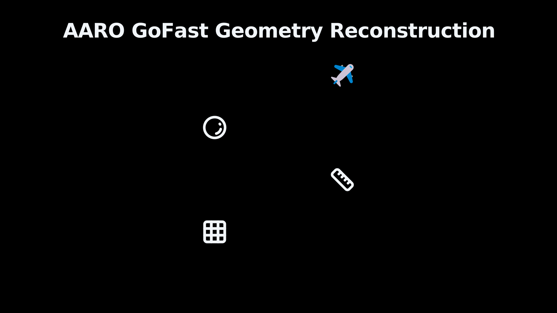
The key concept is a line-of-sight vector: an imaginary line starting at the sensor and pointing towards the tracked object. Its direction comes from the sensor’s angles. If the target’s range is also known, the line acquires a length, turning a direction into a three-dimensional relative position.
AARO’s technical reconstruction formalised that procedure by placing the F/A-18 in a three-dimensional Cartesian coordinate system. It began with a vector pointing forward from the aircraft, gave that vector a length equal to the reported target range, then rotated it according to the sensor’s elevation and azimuth. The endpoint was the reconstructed target position relative to the aircraft.[AARO]aaro.milGo Fast Case ResolutionAARO GoFast Case Resolution…
This is more informative than extending the target visually down to whatever surface happens to appear behind it. The ocean can be kilometres behind an airborne object while occupying almost the same pixels in a telephoto image.
Using range and angles to locate the target
GoFast provides an unusually useful public demonstration because several quantities needed for the reconstruction are visible directly in the recording.
For the 13-second interval used in AARO’s detailed analysis, one selected frame showed the aircraft at about 25,000 feet, the sensor looking 29 degrees downwards and 49 degrees to the left, and a target range of 4.0 nautical miles. Thirteen seconds later, the displayed range had fallen to 3.4 nautical miles while the sensor angles had changed to 35 degrees down and 57 degrees left. The aircraft was travelling at roughly Mach 0.61–0.62 and banking at about 14 degrees.[AARO]aaro.milGo Fast Case ResolutionAARO GoFast Case Resolution…
At the first of those positions, AARO converted the 4.0-nautical-mile range to 7,408 metres and rotated that line-of-sight vector through the recorded sensor angles. The resulting relative position placed the object 3,591 metres below the F/A-18. Subtracting that vertical separation from the aircraft’s altitude produced a target altitude of 4,029 metres, or 13,219 feet.[AARO]aaro.milGo Fast Case ResolutionAARO GoFast Case Resolution…
That calculation is important because the object’s altitude is not being inferred from its apparent distance above the waves. It emerges from the sensor geometry.
NASA had previously demonstrated the same basic principle in its 2023 UAP Independent Study Team report. Its simpler treatment used the camera elevation, target range and aircraft altitude shown on the display to put the object at about 13,000 feet. NASA emphasised that the target was therefore about 4.2 miles above the ocean visible behind it rather than travelling immediately over the surface.[NASA]nasa.govuap independent study team final report 0uap independent study team final report 0
The agreement is significant even though NASA’s and AARO’s subsequent speed treatments were not identical. The central altitude result is a straightforward geometric consequence of treating the reported range and pointing information as meaningful measurements rather than treating the background as the target’s location.
Reconstruction can follow the target through time
A single reconstructed position gives altitude. Repeating the operation at successive times begins to reveal a trajectory.
This requires accounting for the camera platform as well as the target. The F/A-18 was itself moving rapidly and turning, so its second position could not simply be treated as though the camera had remained at the first observation point. AARO modelled the aircraft’s curved path from its speed and approximately 14-degree bank, deriving a turning radius of about 14.8 kilometres before calculating subsequent lines of sight.[AARO]aaro.milGo Fast Case ResolutionAARO GoFast Case Resolution…
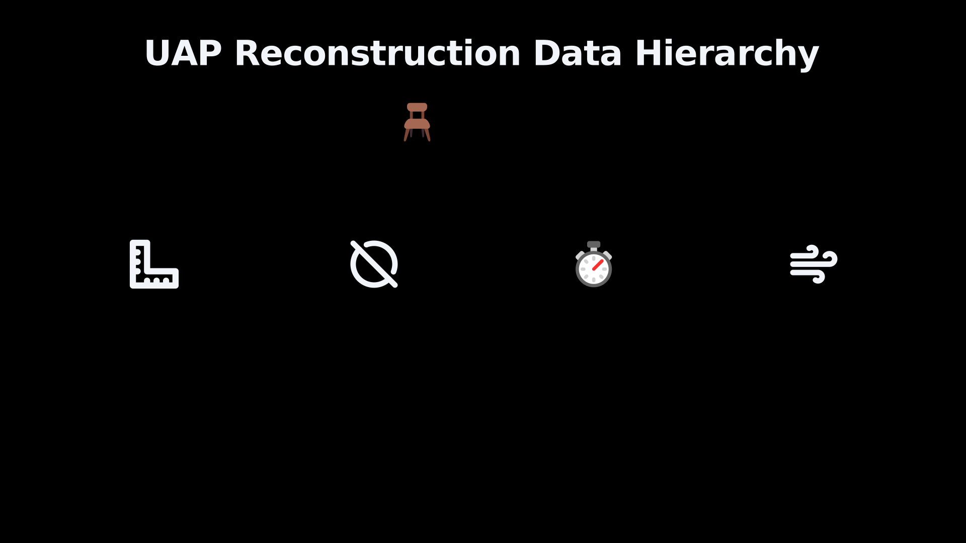
The broader principle is particularly relevant to tracked UAP footage: the target’s movement in the image is only one part of the geometry. A rigorous reconstruction ideally follows four changing quantities together:
- the position and attitude of the sensor platform;
- the direction in which the sensor is pointing;
- the measured or otherwise constrained distance along that line of sight;
- the elapsed time between observations.
Combining them allows successive observations to become three-dimensional positions rather than dots moving across a two-dimensional screen. Displacement between those positions can then constrain velocity.
AARO describes this as an adaptation of standard full-motion-video geospatial analysis. Its GoFast work used mathematical conventions from the US National Geospatial-Intelligence Agency’s Motion Imagery Standards Board. AARO notes that conventional full-motion-video systems can locate surface vehicles because the sensor knows where it is, where it is pointing and where the sightline intersects the ground. An airborne UAP is harder because investigators cannot simply terminate the line of sight at Earth’s surface; its range or some other depth constraint must instead locate it along that line.[AARO]aaro.milGo Fast Case Resolution Card Methodology FinalUNCLASSIFIEDMay 10, 2026…
Why altitude changes the apparent-speed story
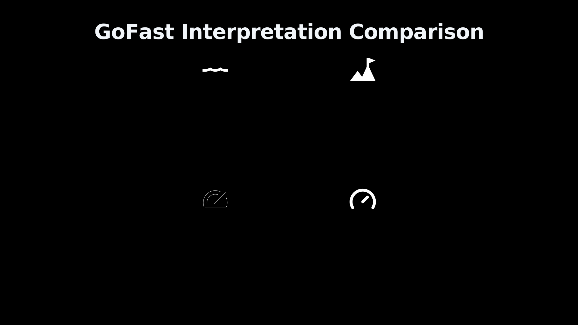
Putting an object at the wrong depth can produce a large error in the speed inferred from a video. The intuitive mistake is to watch the sea or terrain sweeping behind a tracked object and treat that background displacement as though the object itself were crossing the same patch of surface.
GoFast illustrates why that fails. NASA’s reconstruction placed the target thousands of metres above the ocean, while the aircraft carrying the camera was itself travelling at roughly 435 mph. NASA therefore concluded that the striking impression of rapid motion was at least partly caused by the fast-moving sensor platform and parallax.[NASA]nasa.govuap independent study team final report 0uap independent study team final report 0
AARO’s later analysis reached the same broader conclusion but explored a wider range of possible aircraft headings and wind relationships. Its final assessment put the object at approximately 13,000 feet and concluded with high confidence that it did not display anomalous speed. Depending on assumptions about heading and wind, AARO calculated a wind-compensated speed between about 5 and 92 mph rather than the extraordinary velocity suggested by a casual viewing of the footage.[AARO]aaro.milGo Fast Case ResolutionAARO GoFast Case Resolution…
This does not mean that altitude reconstruction automatically explains an unidentified object. In GoFast, AARO explicitly said that it could not definitively identify the object. What the geometry changed was the claimed performance: an unidentified object apparently racing just above the sea became an unidentified object several kilometres above it whose motion did not require anomalous speed.[AARO]aaro.milGo Fast Case ResolutionAARO GoFast Case Resolution…
That distinction is central when evaluating UFO reports. “Unidentified” describes uncertainty about identity; it does not by itself establish unusual acceleration, speed or altitude.
The same method can overturn apparent flight paths
The value of line-of-sight reconstruction is not confined to GoFast. AARO’s analysis of the 2013 Aguadilla, Puerto Rico, infrared recording demonstrates how three-dimensional geometry can alter an entire apparent trajectory.
The Aguadilla footage had been interpreted as showing an object moving rapidly, apparently passing towards or into the sea and seemingly separating into two. AARO’s reconstruction combined the aircraft’s position with sensor parameters including elevation, azimuth and slant geometry. It placed the objects at an altitude of approximately 200 metres (656 feet) when first detected and reconstructed them drifting in a straight line at roughly 3.6 metres per second, close to the recorded wind speed.[AARO]aaro.milPuerto Rico UAP Case ResolutionAARO Puerto Rico UAP Case ResolutionMarch 19, 2025…
Crucially, reconstructing the sensor’s look angle showed that the objects remained over land. The apparent relationship between the targets and the coastline in the two-dimensional infrared image was therefore misleading. AARO concluded that they had not entered the water at all.[AARO]aaro.milPuerto Rico UAP Case ResolutionAARO Puerto Rico UAP Case ResolutionMarch 19, 2025…
The case illustrates the larger evidential point: a background feature is not automatically co-located with the object projected against it. An aircraft, coastline, cloud, mountain or ocean surface can appear directly behind a target while being separated from it by a substantial distance in depth.
What the reconstruction can and cannot prove
Line-of-sight analysis is strongest when range and sensor metadata are reliable. Range supplies the missing depth dimension; pointing angles determine direction; aircraft position and attitude establish the observer’s frame of reference. Remove one of those pieces and the solution can become much less constrained.
GoFast itself demonstrates those limits. AARO had only a compressed public video rather than the original recording and complete metadata. The aircraft’s exact georeferenced position and compass heading were absent. Consequently, AARO could estimate the object’s altitude and relative trajectory but could not derive one unique absolute heading and speed. It instead tested possible aircraft headings across the full 360-degree range. The displayed sensor values were also rounded, adding measurement uncertainty.[AARO]aaro.milGo Fast Case ResolutionAARO GoFast Case Resolution…
NASA has identified missing metadata as a wider problem in UAP analysis. Its independent study noted that UAP observations are commonly incidental rather than designed scientific measurements, and that information about sensor characteristics, acquisition conditions and calibration can be absent. That makes rigorous reconstruction harder and sometimes impossible.[NASA]nasa.govuap independent study team final report 0uap independent study team final report 0
There is therefore an important hierarchy of evidence. A video containing only a moving dot may permit many different combinations of size, range, altitude and speed. A video with accurate camera orientation narrows the possibilities. Add the sensor platform’s position and motion and the geometry becomes stronger. Add trustworthy target range, and a genuine three-dimensional reconstruction may become possible.
Altitude is the missing variable in many speed impressions
The practical lesson for camera-tracked UFO footage is narrower than claiming that parallax explains every unusual recording. It is that speed cannot safely be read from background motion until target depth has been established.
GoFast makes that lesson unusually concrete. The visual impression suggested an object close to the Atlantic and travelling extraordinarily fast. NASA’s relatively simple trigonometric calculation and AARO’s more elaborate line-of-sight reconstruction instead converged on an altitude of roughly 13,000 feet. Once that depth was restored to the scene, the rapidly sweeping ocean ceased to be a trustworthy ruler for the object’s motion.[NASA]nasa.govuap independent study team final report 0uap independent study team final report 0
For UFO and UAP analysis, this is why range, viewing angles and platform telemetry can be more probative than the spectacle of the video itself. A tracking camera compresses a three-dimensional encounter into a flat image. Reconstructing the line of sight reverses part of that compression, separating the object from the background and allowing claims about altitude — and therefore apparent speed — to be tested against geometry rather than visual intuition.
Amazon book picks
Further Reading
Books and field guides related to Can Tracking Data Reveal a UFO's True Altitude?. Use these as the next step if you want deeper reading beyond the article.
Introduction to Modern Photogrammetry
This text is designed to give students a strong grounding in the mathematical basis of photogrammetry while introducing them to related f...
Elements of Photogrammetry with Applications in GIS
The first new edition in 13 years incorporates recent changes on the subject of streamlining from advances in computers. Their ever incre...
Optics
For courses in Optics A Contemporary Approach to Optics with Practical Applications and New Focused Pedagogy Hecht Optics balances theory...
Applied Photographic Optics
Selected by the American Library Association's 'Choice' magazine as "best technical book", the first edition of this book soon establishe...
eBay marketplace picks
Marketplace Samples
Live-tested eBay searches with available results related to this page.
Selected fromUFO model oneBay.co.uk.



Endnotes
1.
Source: nasa.gov
Title: uap independent study team final report 0
Link:https://www.nasa.gov/wp-content/uploads/2023/09/uap-independent-study-team-final-report-0.pdf?emrc=673db44e4b24e
2.
Source: aaro.mil
Title: Go Fast Case Resolution
Link:https://www.aaro.mil/Portals/136/PDFs/case_resolution_reports/AARO_GoFast_Case_Resolution_Card_Methodology_Final.pdf
Source snippet
AARO GoFast Case Resolution...
3.
Source: aaro.mil
Title: Go Fast Case Resolution Card Methodology Final
Link:https://www.aaro.mil/Portals/136/PDFs/case_resolution_reports/AARO_GoFast_Case_Resolution_Card_Methodology_Final.pdf?ver=qXvjrruO_0MgtnTsfYnCEQ%3D%3D
Source snippet
UNCLASSIFIEDMay 10, 2026...
Published: May 10, 2026
4.
Source: aaro.mil
Title: Puerto Rico UAP Case Resolution
Link:https://www.aaro.mil/Portals/136/PDFs/case_resolution_reports/AARO_Puerto_Rico_UAP_Case_Resolution.pdf
Source snippet
AARO Puerto Rico UAP Case ResolutionMarch 19, 2025...
Published: March 19, 2025
5.
Source: aaro.mil
Title: UAP Case RR Data Table
Link:https://www.aaro.mil/Next-AARO-Home-redesign/Next-Parent/Next-UAP-Case-RR-Data-Table/
Source snippet
AARO UAP Case RR Data Table...
6.
Source: aaro.mil
Link:https://www.aaro.mil/Next-AARO-Home-redesign/Next-Parent/Next-AARO-UAP-Imagery-Acc-Table/
7.
Source: science.nasa.gov
Link:https://science.nasa.gov/uap/faqs/
8.
Source: science.nasa.gov
Link:https://science.nasa.gov/uap/
9.
Source: nasa.gov
Title: Artemis II: The Ground Teams Powering NASA’s Moon Mission
Link:https://www.nasa.gov/podcasts/curious-universe/artemis-ii-the-ground-teams-powering-nasas-moon-mission/
10.
Source: landsat.visibleearth.nasa.gov
Link:https://landsat.visibleearth.nasa.gov/view.php?id=80017
11.
Source: landsat.visibleearth.nasa.gov
Link:https://landsat.visibleearth.nasa.gov/view.php?id=147895
12.
Source: nasa.gov
Title: Scientific Balloon FAQs
Link:https://www.nasa.gov/scientificballoons/faqs/
13.
Source: science.nasa.gov
Title: chapter3 4
Link:https://science.nasa.gov/learn/basics-of-space-flight/chapter3-4/
14.
Source: aaro.mil
Link:https://www.aaro.mil/Next-AARO-Home-redesign/Next-Parent/Presidential-UAP-Transparency-Initiative/videoid/1006159/dvpmoduleid/77396/
15.
Source: aaro.mil
Link:https://www.aaro.mil/Next-AARO-Home-redesign/Next-Parent/Presidential-UAP-Transparency-Initiative/videoid/1010276/dvpcc/false/
16.
Source: navy.mil
Title: A N/SPS-49(V) [Radar]({{ ‘radar/’ | relative_url }}) Set > United States Navy > Display-Fact Files
Link:https://www.navy.mil/Resources/Fact-Files/Display-FactFiles/Article/2167967/ansps-49v-radar-set/
17.
Source: navy.mil
Title: A N/SPS-48G > United States Navy > Display-Fact Files
Link:https://www.navy.mil/Resources/Fact-Files/Display-FactFiles/Article/2167957/ansps-48g/
18.
Source: history.navy.mil
Link:https://www.history.navy.mil/research/library/online-reading-room/title-list-alphabetically/u/operational-characteristics-of-radar-classified-by-tactical-application.html
19.
Source: history.navy.mil
Title: mil United States Naval Railway Batteries in France
Link:https://www.history.navy.mil/content/history/nhhc/research/library/online-reading-room/title-list-alphabetically/u/us-naval-railway-batteries-france.html
20.
Source: ntrs.nasa.gov
Link:https://ntrs.nasa.gov/citations/20200004324
21.
Source: history.navy.mil
Title: compass m2
Link:https://www.history.navy.mil/our-collections/artifacts/Navigation/Compasses/compass–m2.html
22.
Source: aaro.mil
Link:https://www.aaro.mil/Next-AARO-Home-redesign/Next-Parent/Presidential-UAP-Transparency-Initiative/videoid/1006105/dvpmoduleid/77396/
23.
Source: ntrs.nasa.gov
Link:https://ntrs.nasa.gov/citations/20180005323
24.
Source: ntrs.nasa.gov
Link:https://ntrs.nasa.gov/citations/20180005329
25.
Source: espo.nasa.gov
Title: Gulfstream G 1
Link:https://espo.nasa.gov/oib/aircraft/Gulfstream_G-1
26.
Source: nasa.gov
Title: Gulfstream G-III Aerodynamics Research Test Bed
Link:https://www.nasa.gov/aeronautics/g-iii/
27.
Source: nasa.gov
Title: WAS P Gives NASA’s Planetary Scientists New Observation Platform
Link:https://www.nasa.gov/centers-and-facilities/goddard/wasp-gives-nasas-planetary-scientists-new-observation-platform/
28.
Source: nasa.gov
Title: NAS A Builds Unusual Testbed for Analyzing X-ray Navigation Technologies
Link:https://www.nasa.gov/technology/science-instruments/nasa-builds-unusual-testbed-for-analyzing-x-ray-navigation-technologies/
29.
Source: navair.navy.mil
Link:https://www.navair.navy.mil/node/10591
30.
Source: ntrs.nasa.gov
Link:https://ntrs.nasa.gov/citations/20040171179
31.
Source: ntrs.nasa.gov
Link:https://ntrs.nasa.gov/citations/19850052809
32.
Source: aaro.mil
Link:https://www.aaro.mil/UAP-Cases/Official-UAP-Imagery/4/
33.
Source: aaro.mil
Link:https://www.aaro.mil/Next-AARO-Home-redesign/Next-Parent/AARO-UAP-Case-Resolution-DT/
34.
Source: aaro.mil
Link:https://www.aaro.mil/Next-AARO-Home-redesign/Next-Parent/Next-AARO-UAP-Imagery-Fixed-Table/
35.
Source: aaro.mil
Title: AAR O UAP Trends All-domain Anomaly Resolution Office UAP REPORTING TRENDS
Link:https://www.aaro.mil/UAP-Cases/UAP-Reporting-Trends/
36.
Source: aaro.mil
Link:https://www.aaro.mil/UAP-Cases/Official-UAP-Imagery/ftag/MSF0951a18/
37.
Source: aaro.mil
Link:https://www.aaro.mil/Next-AARO-Home-redesign/Next-Parent/AARO-UAP-Case-DT/
38.
Source: aaro.mil
Title: UAP Imagery* “Go Fast” Object NAVAIR
Link:https://www.aaro.mil/Next-AARO-Home-redesign/Inactive-Parent/Next-UAP-Imagery-dup/
39.
Source: aaro.mil
Link:https://www.aaro.mil/Next-AARO-Home-redesign/Next-Parent/Next-AARO-UAP-Trends/
40.
Source: aaro.mil
Link:https://www.aaro.mil/Next-AARO-Home-redesign/Bruce-working/Next-AARO-UAP-Trends-Charts/
41.
Source: aaro.mil
Title: AAR O UAP Trends All-domain Anomaly Resolution Office UAP REPORTING TRENDS
Link:https://www.aaro.mil/UAP-Cases/UAP-Reporting-Trends/quot/
42.
Source: nlsp.nasa.gov
Title: lsda experiment
Link:https://nlsp.nasa.gov/explore/mtable/lsda_experiment/lsda_experiment
43.
Source: www1.grc.nasa.gov
Title: altitude equation derivation
Link:https://www1.grc.nasa.gov/beginners-guide-to-aeronautics/altitude-equation-derivation/
44.
Source: www1.grc.nasa.gov
Link:https://www1.grc.nasa.gov/beginners-guide-to-aeronautics/range-summary/
45.
Source: www1.grc.nasa.gov
Title: graphical maximum altitude
Link:https://www1.grc.nasa.gov/beginners-guide-to-aeronautics/graphical-maximum-altitude/
46.
Source: www1.grc.nasa.gov
Title: ballistic flight equations
Link:https://www1.grc.nasa.gov/beginners-guide-to-aeronautics/ballistic-flight-equations/
47.
Source: aa.usno.navy.mil
Link:https://aa.usno.navy.mil/faq/alt_az
48.
Source: cnmoc.usff.navy.mil
Link:https://www.cnmoc.usff.navy.mil/Our-Commands/United-States-Naval-Observatory/Precise-Time-Department/Global-Positioning-System/Global-Positioning-System-Overview/USNO-GPS-Data-Categories-Explanation/
49.
Source: aa.usno.navy.mil
Link:https://aa.usno.navy.mil/data/mrst
50.
Source: aa.usno.navy.mil
Link:https://aa.usno.navy.mil/data/AltAz
51.
Source: cnmoc.usff.navy.mil
Link:https://www.cnmoc.usff.navy.mil/our-commands/united-states-naval-observatory/precise-time-department/global-positioning-system/global-positioning-system-overview/cggtts-data-format/
52.
Source: doncio.navy.mil
Link:https://www.doncio.navy.mil/Chips/ArticleDetails.aspx?ID=5550
53.
Source: fliphtml5.com
Title: UAP Independent Study Team
Link:https://fliphtml5.com/tdcwe/oiyf/UAP_Independent_Study_Team_-_Final_Report_0-1/
54.
Source: frontiersin.org
Link:https://www.frontiersin.org/journals/earth-science/articles/10.3389/feart.2023.1211450/full
Additional References
55.
Source: wikidisc.org
Title: Jellyfish UFO video | Wiki Disc
Link:https://www.wikidisc.org/wiki/Jellyfish_UFO_video
Source snippet
Jellyfish UFO video | WikiDiscJuly 1, 2026 — AARO CASE RESOLUTION[EDIT | EDIT SOURCE] On September 8, 2025, the All-domain Anomaly Resolu...
Published: July 1, 2026
56.
Source: aatip.com
Title: UAP Case Files & Official Reports | AATIP.com
Link:https://www.aatip.com/inpage/case-files/
Source snippet
Recorded by a U.S. Navy F/A-18F in January 2015 off Florida, GoFast appears to show a small target raci...
Published: January 2015
57.
Source: congress.gov
Link:https://www.congress.gov/event/118th-congress/house-event/117600
58.
Source: congress.gov
Link:https://www.congress.gov/event/118th-congress/senate-event/336312
59.
Source: faa.gov
Link:https://www.faa.gov/air_traffic/publications/atpubs/aip_html/part2_enr_section_1.5.html
60.
Source: usgs.gov
Link:https://www.usgs.gov/publications/high-resolution-and-accurate-topography-reconstruction-[mount-etna
61.
Source: congress.gov
Link:https://www.congress.gov/event/118th-congress/house-event/LC73681/text
62.
Source: congress.gov
Link:https://www.congress.gov/event/118th-congress/house-event/117721
63.
Source: congress.gov
Link:https://www.congress.gov/event/118th-congress/house-event/117722
64.
Source: youtube.com
Title: The SHOCKING Math Error Behind Viral UFO Videos | Mick West
Link:https://www.youtube.com/watch?v=ypfbhfEXnBo
Source snippet
Quantum physicists analyze pentagon US navy UFO video footage...