Within Field of View
What Data Is Needed to Measure UFO Motion?
Range, timing, aircraft attitude and sensor pointing data are needed to turn dramatic screen movement into a defensible estimate of UFO motion.
On this page
- The difference between image, line of sight and true motion
- Which sensor and aircraft measurements constrain the geometry
- Why missing metadata leaves speed and direction uncertain
Page outline Jump by section
Introduction
A UFO or UAP video can show an image moving dramatically without establishing that the object itself is moving dramatically. To turn motion on a sensor display into a defensible estimate of real three-dimensional motion, analysts need the geometry behind the picture: range to the target, precise timing, the observing aircraft’s position and velocity, its attitude, and the sensor’s pointing angles. Without those measurements, apparent speed can be dominated by the motion of the camera platform, particularly in a narrow field of view.
The 2015 Navy “GoFast” video provides an unusually clear demonstration. NASA concluded that the apparent anomalous behaviour could largely be explained by the sensor platform’s motion, while a later All-domain Anomaly Resolution Office (AARO) reconstruction used displayed range, sensor angles and aircraft data to constrain the object’s altitude and speed. Crucially, AARO could produce only a range of possible speeds because important original metadata — including the aircraft’s exact position and heading — was unavailable.[NASA]nasa.govuap independent study team final report 0UNIDENTIFIED ANOMALOUS PHENOMENA…
Image motion, line-of-sight motion and true motion are different
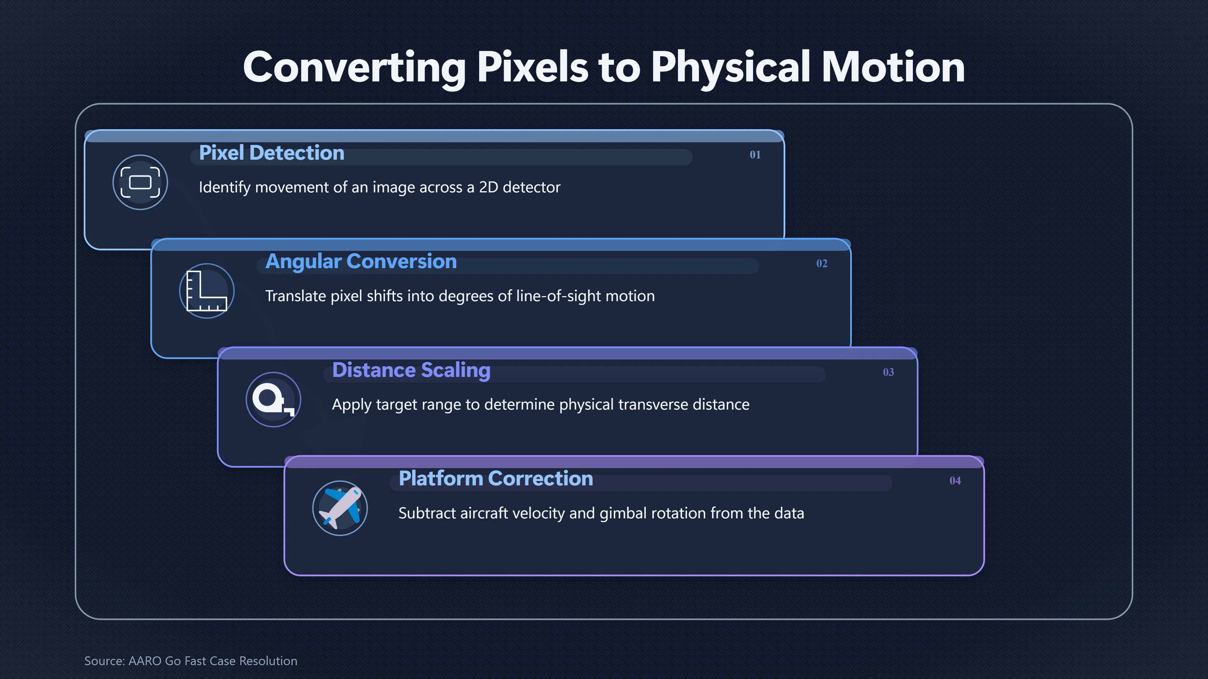
A video frame is fundamentally a two-dimensional angular view. If a small object shifts ten pixels between two frames, that establishes that its image has moved across the detector. By itself, it does not establish how many metres the object travelled.
The first conversion is from pixels to angular or line-of-sight motion. That requires knowing such things as the sensor’s field of view, optical state and pointing direction. The next conversion — from changing viewing angle to motion through three-dimensional space — is harder because distance matters. An object crossing one degree of sky at a range of 500 metres travels a much shorter transverse distance than an object crossing the same angle at 10 kilometres.
The observer’s movement must also be removed. An airborne infrared camera may itself be travelling at hundreds of kilometres per hour while turning and banking. Its gimbal can simultaneously rotate to keep a tracked object near the centre of the display. The resulting picture is therefore generated by several motions at once:
- the object’s movement;
- the aircraft’s translation through space;
- changes in aircraft heading, pitch and roll;
- the sensor gimbal’s changing azimuth and elevation;
- and, where relevant, stabilisation or tracking that deliberately keeps the target in approximately the same screen position.
That distinction explains why the visually obvious movement in a narrow-field video is not automatically the object’s ground speed. A stationary or slowly moving object can acquire substantial apparent angular motion when viewed from a fast-moving aircraft, while a tracking sensor can make the object appear comparatively fixed and cause the background to sweep through the frame. AARO specifically identifies observer motion and motion parallax as mechanisms capable of creating misleading impressions of UAP speed.[AARO]aaro.milAARO FAQ…
A useful way to think about the problem is that the video supplies observations, whereas metadata supplies the coordinate system needed to interpret them. The stronger the metadata, the fewer geometrically possible trajectories remain.
Which measurements constrain the geometry?
For an airborne electro-optical or infrared observation, analysts ideally want a time-synchronised record of both the platform and the sensor. This is not a special requirement invented for UFO analysis. Geospatial full-motion-video systems routinely associate imagery with telemetry describing platform position, attitude and sensor pointing. For example, metadata used with Motion Imagery Standards Board conventions can include timestamps, platform heading, pitch and roll, sensor location and altitude, field of view, and sensor-relative azimuth and elevation.[Esri Support]support.esri.comEsri SupportWhat Are the Full Motion Video Add-In's Motion Imagery Standards Board (MISB) Metadata ReqJuly 14, 2017…
For UAP motion analysis, several measurements are especially important.
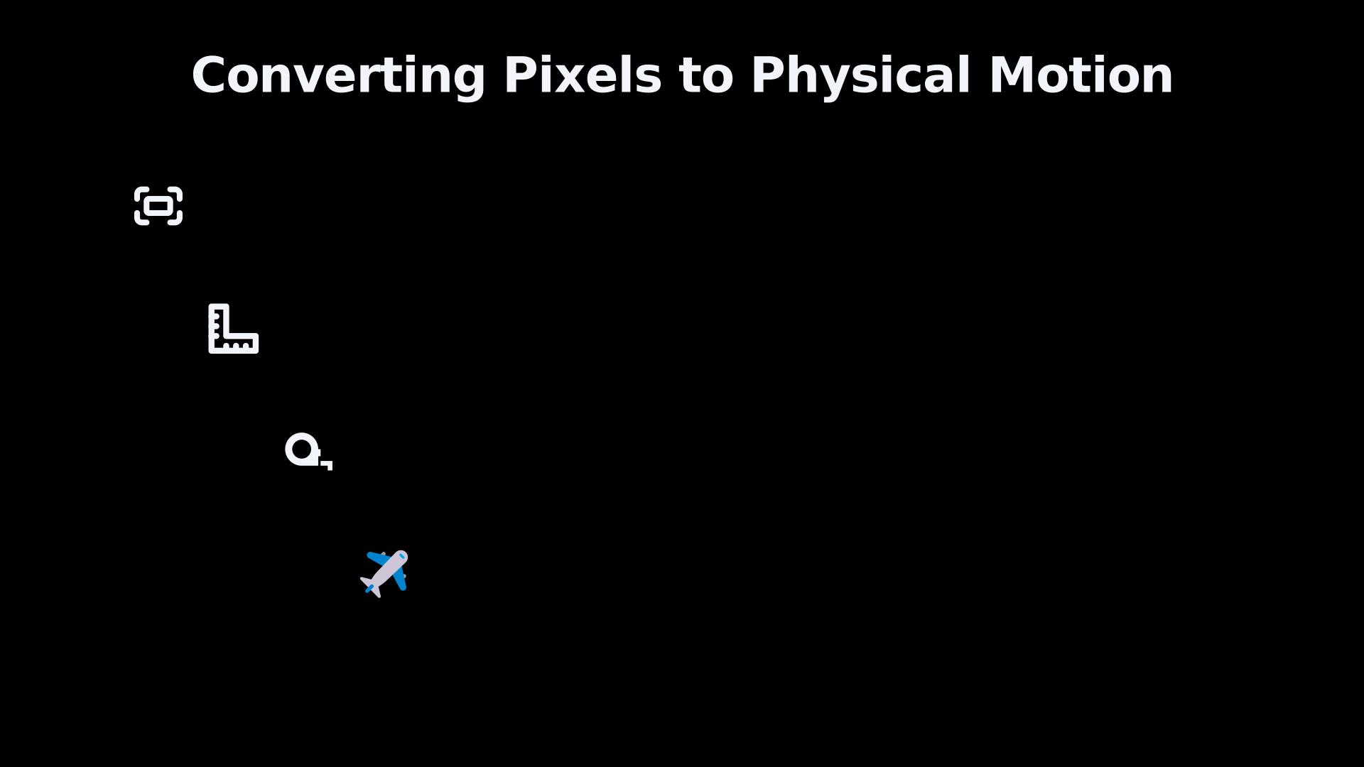
Range to the target. Range converts angular geometry into physical scale. If the line of sight rotates by a known amount but target distance is unknown, there can be many possible trajectories consistent with the same video. Direct ranging from radar or another suitable system is therefore particularly valuable.
Precise timestamps. Speed is distance divided by time, so frames and measurements must be accurately time-tagged. Timing becomes even more important when analysts combine several sensors: an infrared observation at one instant cannot simply be matched to a radar position recorded at an uncertain neighbouring time.
Aircraft position and velocity. Latitude, longitude, altitude and velocity establish where the observing platform was and how it moved during the observation. Without them, analysts may be able to calculate relative movement while remaining unable to place the target’s trajectory accurately in an Earth-fixed coordinate system.
Aircraft attitude. Heading, pitch and roll describe the aircraft’s orientation. This matters because a sensor pointing, for example, 20 degrees to one side of an aircraft is not pointing in a fixed geographic direction when the aircraft turns or banks.
Sensor pointing angles. Gimbal azimuth and elevation tell analysts where the camera was looking relative to the aircraft. Combined with platform attitude, these measurements can establish the line of sight in geographic coordinates.
Sensor configuration and calibration. Field of view, zoom or optical state, distortion characteristics and calibration uncertainties affect the conversion between image coordinates and viewing angles. NASA’s UAP study identified poor calibration and missing sensor metadata as major obstacles to rigorous analysis and recommended systematic calibration, multiple measurements and thorough metadata.[NASA]nasa.govUPDATE: NASA Shares UAP Independent Study Report; Names DirectorUPDATE: NASA Shares UAP Independent Study Report; Names Director - NASASeptember 14, 2023…
These measurements are most powerful when recorded together rather than reconstructed afterwards. A time series of platform position, attitude, sensor orientation and range can generate successive three-dimensional target-position estimates. Differences between those positions then provide estimates of velocity and direction, with uncertainties propagated from the underlying measurements.

GoFast shows what metadata can change
The Navy’s “GoFast” recording is valuable here not because AARO ultimately identified the object — it did not — but because the case demonstrates how telemetry can change the interpretation of apparently spectacular screen motion.
AARO’s February 2025 case resolution analysed the publicly available 34-second infrared recording. The display contained several useful measurements: range from the sensor to the target, sensor azimuth and elevation, and the F/A-18’s altitude, speed and bank angle. During the 13-second interval selected for detailed analysis, displayed range decreased from 4.0 nautical miles to 3.4 nautical miles.[AARO]aaro.milGo Fast Case Resolution Card Methodology FinalUNCLASSIFIEDMay 10, 2026…
Those values allowed AARO to estimate the object’s position at separated times rather than simply judging its speed from the background racing through the image. Its reconstruction placed the object at approximately 13,000 feet and concluded with high confidence that it was not travelling at anomalous speed. After accounting for wind, AARO calculated a possible speed range of roughly 5 to 92 mph, depending on the reconstructed heading. It attributed the striking visual impression of high speed principally to motion parallax.[AARO]aaro.milGo Fast Case ResolutionAARO GoFast Case Resolution…
That is a much more informative result than saying that the object “looks fast”. Yet the analysis also illustrates the limitations imposed by incomplete metadata.
AARO did not possess the original sensor file and its accompanying metadata. Its source was a compressed Windows Media Video file, and the aircraft’s georeferenced position and exact heading were missing. Those omissions prevented AARO from calculating one unique absolute trajectory. Instead, it modelled possible aircraft headings through 360 degrees and derived a corresponding range of possible object speeds and directions.[AARO]aaro.milGo Fast Case Resolution Card Methodology FinalUNCLASSIFIEDMay 10, 2026…
This distinction is important. The case did not move directly from “unknown object” to a precisely measured conventional trajectory. It moved from a dramatic but poorly interpreted visual impression to a substantially constrained set of physically possible trajectories. Better metadata narrowed the problem; missing metadata prevented it from being narrowed to a single solution.
NASA had already used GoFast to make essentially the same methodological point. Its 2023 independent UAP study reported that many events could not be conclusively characterised because their data and metadata were inadequate, while noting that GoFast was an example in which apparent anomalous behaviour could be explained substantially by sensor-platform motion.[NASA]nasa.govuap independent study team final report 0UNIDENTIFIED ANOMALOUS PHENOMENA…
Why one missing variable can leave many possible speeds
The importance of metadata is easiest to see by imagining an analyst trying to reconstruct a target at two moments.
Suppose the sensor provides azimuth and elevation at both times. Those measurements define two lines extending outward from the aircraft. If target range is also known, a point can be placed along each line. But those points are meaningful only if the analyst also knows where the aircraft was at each instant and how its coordinate system was oriented.
Remove the range measurement and each observation becomes a line of possible target locations rather than a point. Remove aircraft heading and the line’s geographic direction becomes uncertain. Remove accurate timing and even a well-estimated displacement cannot be converted reliably into speed. Introduce uncertainty in several of these quantities simultaneously and the number of compatible trajectories grows rapidly.
This is why apparent angular speed alone cannot establish extraordinary acceleration or velocity. A claim that an object travelled a particular distance requires evidence for its position at different times. A claim that it accelerated requires sufficiently precise successive velocity estimates. The more extraordinary the inferred kinematics, the more important those uncertainty bounds become.
AARO’s GoFast methodology exposes this issue unusually clearly. Although the display retained enough information for a useful reconstruction, the missing aircraft heading meant the office had to calculate results across all possible headings rather than present one exact target velocity. The displayed sensor values themselves also had limited numerical precision, adding further uncertainty.[AARO]aaro.milGo Fast Case ResolutionAARO GoFast Case Resolution…
The lesson therefore cuts in both directions. Missing metadata does not prove that a UFO was moving slowly, but neither does it permit a defensible claim that dramatic screen motion represents extreme physical speed. It leaves the kinematics underdetermined.
Multiple sensors can break the ambiguity
A single moving camera is not the only way to estimate a target’s trajectory. Independent observations can constrain the geometry much more strongly.
Two spatially separated, synchronised observations can provide different lines of sight to the same object. If the correspondence and calibration are reliable, their intersection can constrain three-dimensional position through triangulation. Radar range can similarly supply the distance information that a camera alone lacks. Repeated measurements can then establish a track rather than merely an angular trace.
This is one reason NASA’s UAP study emphasised multiple, well-calibrated sensors, not merely higher-resolution photographs. NASA described present UAP analysis as being hampered by poor calibration, missing metadata, lack of multiple measurements and inadequate baseline data. Its recommendation was to improve those ingredients together.[NASA]nasa.govUPDATE: NASA Shares UAP Independent Study Report; Names DirectorUPDATE: NASA Shares UAP Independent Study Report; Names Director - NASASeptember 14, 2023…
Experimental UAP-observation projects are adopting a similar philosophy. The Galileo Project’s observatory architecture, for example, is explicitly designed around multi-sensor collection, calibration and data provenance rather than isolated imagery. Its infrared-camera work has used known aircraft positions from Automatic Dependent Surveillance–Broadcast data as calibration references.[arXiv]arxiv.orgarXiv Galileo Project Observatory Class System ArchitectureGalileo Project Observatory Class System ArchitectureMay 30, 2025…
For motion claims, this matters more than simply collecting additional videos. Ten cameras with unknown clock offsets, uncertain orientations and no calibration may still leave substantial ambiguity. A smaller set of accurately synchronised and calibrated instruments can be far more informative because their measurements can be placed in the same spatial and temporal coordinate system.
Why missing metadata leaves speed and direction uncertain
The practical dividing line in a UAP video is therefore not between footage that looks impressive and footage that does not. It is between observations whose geometry can be reconstructed and those whose geometry cannot.
A strong motion dataset would preserve the original sensor output alongside accurate timestamps, aircraft coordinates and velocity, platform attitude, sensor pointing angles, field of view or optical state, calibration information, range measurements where available, and uncertainty estimates. Corroborating radar or independent optical observations can constrain the solution further. These are broadly the kinds of positional, attitudinal and pointing fields already used to geolocate airborne full-motion video.[Esri Support]support.esri.comEsri SupportWhat Are the Full Motion Video Add-In's Motion Imagery Standards Board (MISB) Metadata ReqJuly 14, 2017…
By contrast, a cropped or transcoded video can lose precisely the information needed to distinguish target motion from observer motion. A viewer may still be able to say that a bright or dark image moved relative to the frame or background. Claims about altitude, ground speed, acceleration or direction require additional assumptions, and those assumptions should be made explicit.
That distinction also helps explain why “unidentified” is not synonymous with “demonstrated anomalous performance”. AARO notes that some reports remain unidentified simply because sensors did not collect enough information for a positive attribution.[AARO]aaro.milAARO FAQ… The 2021 US intelligence assessment likewise cautioned that apparently unusual flight characteristics could require further analysis because sensor errors or observer misperception were among the possible explanations.[UAP Records Archive]uap-archive.orgodni 2021 preliminary assessment uapUAP Records ArchiveODNI Preliminary Assessment on UAP (2021) | UAP Records ArchiveJune 25, 2021…
For narrow-field UFO footage, metadata is consequently not an optional technical extra. It is what separates a compelling impression of movement from a measurable trajectory. GoFast demonstrates the difference particularly well: the visible scene suggested an object streaking close above the ocean, but incorporating range, aircraft motion and sensor pointing geometry produced a substantially different physical interpretation. At the same time, the loss of original positional and heading metadata prevented a unique reconstruction. The scientifically defensible conclusion is therefore bounded by the measurements: screen motion can be obvious while true speed remains uncertain, and only sufficiently complete sensor and platform data can close that gap.
Amazon book picks
Further Reading
Books and field guides related to What Data Is Needed to Measure UFO Motion?. Use these as the next step if you want deeper reading beyond the article.
Multiple View Geometry in Computer Vision
A basic problem in computer vision is to understand the structure of a real world scene given several images of it. Techniques for solvin...
Computer Vision: Algorithms and Applications
Computer Vision: Algorithms and Applications explores the variety of techniques used to analyze and interpret images. It also describes c...
An Invitation to 3-D Vision: From Images to Geometric Models
This book is intended to give students at the advanced undergraduate or introduc tory graduate level, and researchers in computer vision,...
Flight Dynamics Principles
Flight dynamicists today need not only a thorough understanding of the classical stability and control theory of aircraft, but also a wor...
eBay marketplace picks
Marketplace Samples
Live-tested eBay searches with available results related to this page.
Selected fromUFO collectible oneBay.co.uk.



Endnotes
1.
Source: nasa.gov
Title: uap independent study team final report 0
Link:https://www.nasa.gov/wp-content/uploads/2023/09/uap-independent-study-team-final-report-0.pdf?emrc=6963547a011d1
Source snippet
UNIDENTIFIED ANOMALOUS PHENOMENA...
2.
Source: aaro.mil
Title: [Go Fast]({{ ‘go-fast/’ | relative_url }}) Case Resolution
Link:https://www.aaro.mil/Portals/136/PDFs/case_resolution_reports/AARO_GoFast_Case_Resolution_Card_Methodology_Final.pdf
Source snippet
AARO GoFast Case Resolution...
3.
Source: aaro.mil
Link:https://www.aaro.mil/FAQ/
Source snippet
AARO FAQ...
4.
Source: support.esri.com
Link:https://support.esri.com/en-us/knowledge-base/what-misb-compliant-metadata-attributes-should-data-hav-000015970
Source snippet
Esri SupportWhat Are the Full Motion Video Add-In's Motion Imagery Standards Board (MISB) Metadata ReqJuly 14, 2017...
Published: July 14, 2017
5.
Source: nasa.gov
Title: UPDATE: NASA Shares UAP Independent Study Report; Names Director
Link:https://www.nasa.gov/news-release/update-nasa-shares-uap-independent-study-report-names-director/
Source snippet
UPDATE: NASA Shares UAP Independent Study Report; Names Director - NASASeptember 14, 2023...
Published: September 14, 2023
6.
Source: aaro.mil
Title: Go Fast Case Resolution Card Methodology Final
Link:https://www.aaro.mil/Portals/136/PDFs/case_resolution_reports/AARO_GoFast_Case_Resolution_Card_Methodology_Final.pdf?ver=qXvjrruO_0MgtnTsfYnCEQ%3D%3D
Source snippet
UNCLASSIFIEDMay 10, 2026...
Published: May 10, 2026
7.
Source: arxiv.org
Title: arXiv Galileo Project Observatory Class System Architecture
Link:https://arxiv.org/abs/2506.00125
Source snippet
Galileo Project Observatory Class System ArchitectureMay 30, 2025...
Published: May 30, 2025
8.
Source: arxiv.org
Link:https://arxiv.org/abs/2411.07956
9.
Source: catalog.data.gov
Link:https://catalog.data.gov/dataset/timed-global-ultraviolet-imager-guvi-airglow-flux-14-day-movies-at-wavelength-1216-a-in-me
10.
Source: catalog.data.gov
Link:https://catalog.data.gov/dataset/maven-multiple-instrument-ensemble-in-situ-observations-data-product-bundle-key-parameter-
11.
Source: science.nasa.gov
Link:https://science.nasa.gov/uap/faqs/
12.
Source: aaro.mil
Link:https://www.aaro.mil/Next-AARO-Home-redesign/Next-Parent/Next-AARO-UAP-Imagery-Acc-Table/
13.
Source: aaro.mil
Link:https://www.aaro.mil/Next-AARO-Home-redesign/Next-Parent/Next-UAP-Report-Documents/poster/dividLink/
14.
Source: science.nasa.gov
Link:https://science.nasa.gov/uap/
15.
Source: aaro.mil
Link:https://www.aaro.mil/Next-AARO-Home-redesign/Next-Parent/Presidential-UAP-Transparency-Initiative/dvpmoduleid/77396/
16.
Source: aaro.mil
Link:https://www.aaro.mil/Next-AARO-Home-redesign/Next-Parent/Presidential-UAP-Transparency-Initiative/
17.
Source: support.esri.com
Title: what misb compliant metadata attributes should data hav 000015970
Link:https://support.esri.com/es-es/knowledge-base/what-misb-compliant-metadata-attributes-should-data-hav-000015970
18.
Source: support.esri.com
Title: what misb compliant metadata attributes should data hav 000015970
Link:https://support.esri.com/de-de/knowledge-base/what-misb-compliant-metadata-attributes-should-data-hav-000015970
19.
Source: support.esri.com
Title: what misb compliant metadata attributes should data hav 000015970
Link:https://support.esri.com/ja-jp/knowledge-base/what-misb-compliant-metadata-attributes-should-data-hav-000015970
20.
Source: esri.com
Title: Video Multiplexer Geoprocessing Tool to Format your Metadata
Link:https://www.esri.com/arcgis-blog/products/arcgis-pro/imagery/video-multiplexer-tips-tricks
21.
Source: aaro.mil
Link:https://www.aaro.mil/Next-AARO-Home-redesign/Next-Parent/Presidential-UAP-Transparency-Initiative/videoid/1014099/dvpcc/false/
22.
Source: aaro.mil
Link:https://www.aaro.mil/Next-AARO-Home-redesign/Next-Parent/Presidential-UAP-Transparency-Initiative/videoid/1006080/dvpmoduleid/77396/
23.
Source: aaro.mil
Link:https://www.aaro.mil/Next-AARO-Home-redesign/Next-Parent/Presidential-UAP-Transparency-Initiative/videoid/1006082/dvpmoduleid/77396/
24.
Source: nasa.gov
Title: NAS A to Release, Discuss Unidentified Anomalous Phenomena Report
Link:https://www.nasa.gov/news-release/nasa-to-release-discuss-unidentified-anomalous-phenomena-report/
25.
Source: nasa.gov
Title: NAS A Provides Coverage of Unidentified Anomalous Phenomena Meeting
Link:https://www.nasa.gov/news-release/nasa-provides-coverage-of-unidentified-anomalous-phenomena-meeting/
26.
Source: aaro.mil
Link:https://www.aaro.mil/Next-AARO-Home-redesign/Next-Parent/Presidential-UAP-Transparency-Initiative/videoid/1010276/dvpcc/false/
27.
Source: aaro.mil
Link:https://www.aaro.mil/Next-AARO-Home-redesign/Next-Parent/Presidential-UAP-Transparency-Initiative/videoid/1007790/dvpcc/false/
28.
Source: nasa.gov
Title: NAS A Announces Unidentified Aerial Phenomena Study Team Members
Link:https://www.nasa.gov/general/nasa-announces-unidentified-aerial-phenomena-study-team-members/
29.
Source: aaro.mil
Link:https://www.aaro.mil/Next-AARO-Home-redesign/Next-Parent/Presidential-UAP-Transparency-Initiative/videoid/1006056/dvpcc/false/
30.
Source: catalog-beta.data.gov
Title: maven insitu key parameters data bundle
Link:https://catalog-beta.data.gov/dataset/maven-insitu-key-parameters-data-bundle
31.
Source: support.esri.com
Title: what misb compliant metadata attributes should data hav 000015970
Link:https://support.esri.com/pt-br/knowledge-base/what-misb-compliant-metadata-attributes-should-data-hav-000015970
32.
Source: navair.navy.mil
Link:https://www.navair.navy.mil/node/10591
33.
Source: navair.navy.mil
Link:https://www.navair.navy.mil/node/7701
34.
Source: pds.nasa.gov
Title: view Bundle.jsp
Link:https://pds.nasa.gov/ds-view/pds/viewBundle.jsp?identifier=urn%3Anasa%3Apds%3Anh_alice&version=1.0
35.
Source: aaro.mil
Link:https://www.aaro.mil/UAP-Cases/Official-UAP-Imagery/4/
36.
Source: aaro.mil
Link:https://www.aaro.mil/Next-AARO-Home-redesign/Next-Parent/Next-AARO-UAP-Imagery-Fixed-Table/
37.
Source: aaro.mil
Link:https://www.aaro.mil/Next-AARO-Home-redesign/Next-Parent/AARO-UAP-Case-DT/
38.
Source: aaro.mil
Title: AAR O UAP Trends All-domain Anomaly Resolution Office UAP REPORTING TRENDS
Link:https://www.aaro.mil/UAP-Cases/UAP-Reporting-Trends/
39.
Source: aaro.mil
Link:https://www.aaro.mil/Next-AARO-Home-redesign/Next-Parent/Next-AARO-UAP-Trends/
40.
Source: aaro.mil
Title: AAR O UAP Trends All-domain Anomaly Resolution Office UAP REPORTING TRENDS
Link:https://www.aaro.mil/UAP-Cases/UAP-Reporting-Trends/quot/
41.
Source: aaro.mil
Link:https://www.aaro.mil/Next-AARO-Home-redesign/Bruce-working/Next-AARO-UAP-Trends-Charts/
42.
Source: aaro.mil
Link:https://www.aaro.mil/
43.
Source: aaro.mil
Link:https://www.aaro.mil/Next-AARO-Home-redesign/Next-Parent/Next-UAP-Case-RR-Data-Table/
44.
Source: doc.esri.com
Title: create a reality mapping workspace for digital aerial imagery
Link:https://doc.esri.com/en/arcgis-pro/latest/help/data/imagery/create-a-reality-mapping-workspace-for-digital-aerial-imagery.html
45.
Source: uap-archive.org
Title: odni 2021 preliminary assessment uap
Link:https://uap-archive.org/uap/records/odni-2021-preliminary-assessment-uap/
Source snippet
UAP Records ArchiveODNI Preliminary Assessment on UAP (2021) | UAP Records ArchiveJune 25, 2021...
Published: June 25, 2021
46.
Source: odni.gov
Link:https://www.odni.gov/accountability/
47.
Source: uap-archive.org
Link:https://uap-archive.org/uap/records/pursue-uap-records-program/
48.
Source: odni.gov
Title: 4071 astr cy24
Link:https://www.odni.gov/index.php/newsroom/reports-publications/reports-publications-2025/4071-astr-cy24
49.
Source: odni.gov
Title: 4020 uap 2024
Link:https://www.odni.gov/index.php/newsroom/reports-publications/reports-publications-2024/4020-uap-2024?highlight=WyJmb3IiLCJhIiwiYSdzIiwiJ2EiLCJmb3IgYSJd
50.
Source: GOV.UK
Title: www.gov.uk Monitoring ambient air: quality control and quality assurance
Link:https://www.gov.uk/guidance/monitoring-ambient-air-quality-control-and-quality-assurance
51.
Source: odni.gov
Link:https://www.odni.gov/index.php/newsroom/reports-publications/reports-publications-2024/3811-annual-statistical-transparency-report-regarding-national-security-authorities-calendar-year-2023?highlight=WyJzcHkiLCJzcHlpbmciLCJhcyJd
52.
Source: odni.gov
Title: 3787 2024 annual threat assessment of the u s intelligence community
Link:https://www.odni.gov/index.php/newsroom/reports-publications/reports-publications-2024/3787-2024-annual-threat-assessment-of-the-u-s-intelligence-community
53.
Source: odni.gov
Title: 3733 2023 consolidated annual report on unidentified anomalous phenomena
Link:https://www.odni.gov/index.php/newsroom/reports-publications/reports-publications-2023/3733-2023-consolidated-annual-report-on-unidentified-anomalous-phenomena
54.
Source: pubs.usgs.gov
Link:https://pubs.usgs.gov/publication/ofr20231033/full
55.
Source: odni.gov
Link:https://www.odni.gov/index.php/newsroom/press-releases/press-releases-2023/3668-odni-releases-annual-report-on-unidentified-aerial-phenomena
56.
Source: odni.gov
Title: about this site
Link:https://www.odni.gov/index.php/nctc-newsroom/nctc-transparency/194-dni/about-this-site?start=5
57.
Source: ufotransparency.com
Link:https://ufotransparency.com/takeaways/all
58.
Source: uap-archive.org
Title: aaro resources
Link:https://uap-archive.org/uap/records/aaro-resources/
59.
Source: uap-archive.org
Link:https://uap-archive.org/uap/learn/aaro-case-resolution-reports-overview/
60.
Source: uap-archive.org
Link:https://uap-archive.org/uap/learn/pentagon-navy-uap-videos/
61.
Source: odni.gov
Title: reports publications 2024
Link:https://www.odni.gov/index.php/newsroom/reports-publications/reports-publications-2024?start=5
62.
Source: odni.gov
Link:https://www.odni.gov/index.php/foia
63.
Source: odni.gov
Link:https://www.odni.gov/index.php/foia?highlight=WyJkbmkncyIsImRuaSIsImRuaXMiXQ%3D%3D
64.
Source: odni.gov
Title: national security act of 1947
Link:https://www.odni.gov/index.php/ic-legal-reference-book/national-security-act-of-1947
Additional References
65.
Source: nature.com
Link:https://www.nature.com/articles/s41597-026-06668-8
66.
Source: faa.gov
Link:https://www.faa.gov/air_traffic/publications/atpubs/foa_html/chap4_section_7.html
67.
Source: faa.gov
Link:https://www.faa.gov/air_traffic/publications/ATpubs/AIM_html/chap7_section_7.html
68.
Source: defense.gov
Link:https://www.defense.gov/News/News-Stories/Article/Article/3575511/dod-unidentified-anomalous-phenomena-office-[launches
69.
Source: dni.gov
Link:https://www.dni.gov/index.php/what-we-do/foia-reading-room
70.
Source: dni.gov
Link:https://www.dni.gov/index.php/who-we-are/organizations/ic-cio/ic-technical-specifications/multi-audience-tearline
71.
Source: dni.gov
Link:https://www.dni.gov/index.php/who-we-are/organizations/ic-cio/ic-technical-specifications/need-to-know-metadata
72.
Source: dni.gov
Link:https://www.dni.gov/index.php/newsroom/press-releases/press-releases-2023/3668-odni-releases-annual-report-on-unidentified-aerial-phenomena
73.
Source: dni.gov
Link:https://www.dni.gov/index.php/newsroom/reports-publications/reports-publications-2021/3550-preliminary-assessment-unidentified-aerial-phenomena?highlight=WyJvZiJd
74.
Source: defense.gov
Link:https://www.defense.gov/News/Releases/Release/Article/3513171/the-department-of-defense-launches-the-all-domain-anomaly-resolution-office-web/